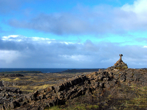
The Icelandic coast of Reykjanes where the Mid-Atlantic Ridge comes above sea level.
A number of Eruptions readers have noticed that seismicity along the Reykjanes Ridge that runs to the southwest of Iceland onto the island has increased over the last few days. Sure enough, checking the Icelandic Met Office page on seismicity on the island finds a lot of earthquakes on the southwest peninsula that is the manifestation of the Mid-Atlantic Ridge hitting the hotspot-related Icelandic landmass. The interaction between the Iceland plume and the Mid-Atlantic Ridge is complex, with a step in the mid-ocean ridge across the island.
There are no recently active volcanoes on the peninsula just south of Reykjavik - most are to the east, such as Krafla, Grimsvötn and Hekla, but the Reykjanes Ridge is part of the SW rift zone, so obviously a place where volcanism could occur. The Reykjanes Ridge is known to have submarine volcanism off the coast of Iceland, with young lava flows discovered in 1992 after seismic swarms. There are many geothermal prospects in this part of Iceland - part of the energy infrastructure of the island nation - along with known basaltic fields. The last known eruption on the of the rift system was in 1879, although there have been numerous eruptions noticed since humans arrived on Iceland in the 9th century, especially at the excellently named submarine Reykjaneshryggur. An eruption in 1830 produced a VEI 3 eruption that might have formed a temporary island. A number of suspected submarine eruptions may have occurred along the Reykjanes near Iceland since 1879. {See a great summary of more eruptions in Iceland in the comments below from Cat Dynamics' Stein Siggurdsson.}
The last eruption on Iceland was at Grímsvötn in 2004, a VEI 3 eruption that produced a jökulhlaup - glacial outburst flood produced by a volcanic eruption. You can see some great images of the event, including pictures of the plume from the eruption taken from aircraft on this website - albeit that the descriptions are in Icelandic. There is even video from the eruption, again in Icelandic (but accompanied by Queen).
{Hat tip to Eruptions readers Mattias Larsson and Boris Behncke for info on this new activity in Iceland.}


Comments (6)
Er, the Iceland has been populated since the 9th century.
There were a series of eruptions on the Reykjanes ridge shortly after colonization, the so-called "landnámsgos", you can see the fresh lava fields as you drive from the airport to Reykjavík. There were 4-5 major eruptions and about a dozen minor eruptions from 875-1340 CE.
The eruptions tend to come at intervals of approximately 1,000 years and last for 2-300 years.
There were underwater eruptions in 1926 and 1973
There were major eruptions off the southwest cost in 1963 (Surtsey) and 1973 (Heimaey) - on the main ridge, not Reykjanes, but historical records suggest submarine eruptions at two spots off Reykjanes in: 1211, 1226, 1231, 1238, 1240, 1422 and 1583; and 1783, 1830 and 1879 respectively.
Posted by: Steinn Sigurdsson | February 18, 2010 7:13 PM