Now on ScienceBlogs: Freethinker Sunday Sermonette: you think, therefore He isn't

Eruptions

A blog of volcanic activity and research worldwide.

Profile

Dr. Erik
Hi! You're looking at Eruptions, a blog dedicated to volcanism. Your host is Dr. Erik Klemetti, a geologist who spends most of his professional time thinking about magma. Looking for info on the latest eruption? You've found the place.

If you like what you read, recommend Eruptions to friends and strangers on Digg, Slashdot, Reddit, Facebook, Technorati or wherever you like.

Search

Recent Posts

Recent Comments

Archives

Links

Volcanoes! Science Blogs - GeoStyle Geology!

Useful Stuff

Locations of visitors to this page

« Tuesday Tidbits: Testing the volcano-earthquake connection in Chile ... and more! | Main | Ask Alan Boyle (science editor for MSNBC.com) your questions on science in mainstream media »

Increasing signs of activity at Eyjafjallajökull in Iceland

Category: EyjafjallajökullEyjafjöllIcelandVolcanic hazardsVolcano monitoringjökulhlaupseismicityspeculationsubglacial volcanism
Posted on: March 4, 2010 8:41 AM, by Erik Klemetti


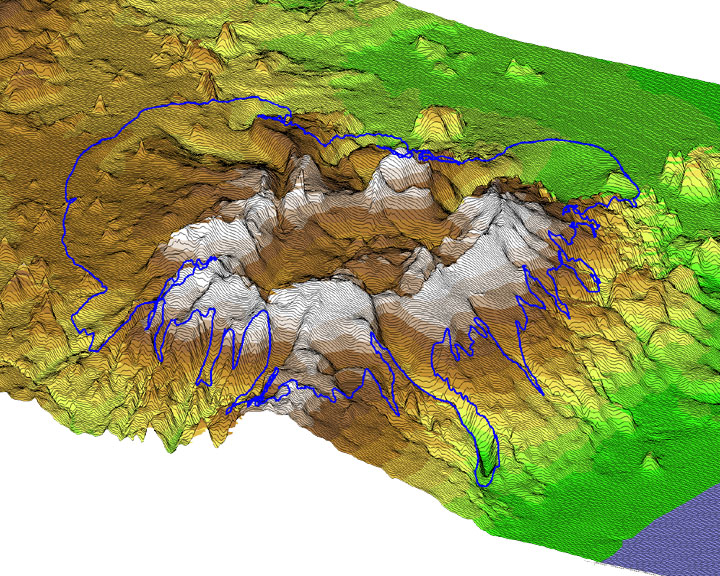
Eyjafjallajökull, an ice-capped volcano in Iceland that last erupted in 1823.

We talked a few weeks ago of signs that there were increasing signs that an eruption could occur on Iceland - increased seismicity on the Reykjanes Ridge suggested that magma might be on the move. Now, we have two pieces of evidence that we might see activity at Eyjafjallajökull, on the southern side of the island nation.

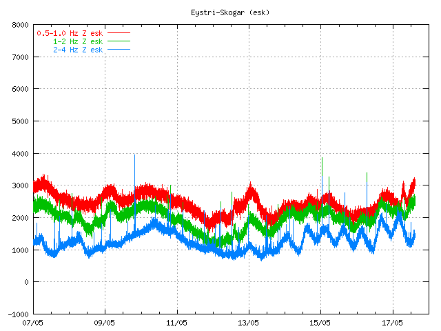
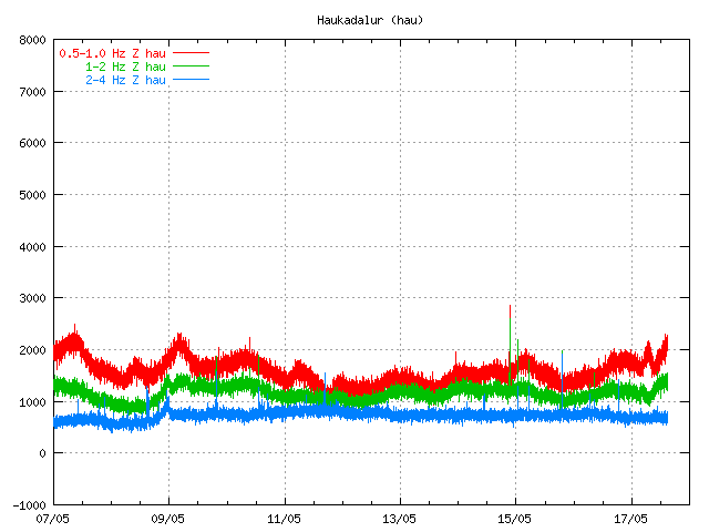
First off, there is a focus of seismicity under the area of Eyjafjallajökull, with an especially large bump in the last 2 days. Both the number and magnitude of the seismicity has been marching upwards, with the latest earthquakes reaching around M3, almost directly underneath the buried (by ice) crater of the volcano. This would suggest that something is up under the ice cap - either magma is moving in the system or the hydrothermal system is experiencing some large fluid flow event. I can't really figure out the depths of these earthquakes based on the Icelandic Met Office page, so any help with that would be greatly appreciated. UPDATE: The depths can be found by clicking the tab above the map marked "table". (Thanks to Bernd for that info.)

Secondly, from what I can gather from a Google Translation of an Icelandic article, there is also signs of inflation at Eyjafjallajökull. The article seems to suggest that the volcano has seen ~40 mm of movement/inflation to the south based on GPS measurements and that the focus of seismicity (when the article was written) was ~10 km below the surface of the volcano. (And any of you Icelandic readers, I'd love to get a better translation!) This would also suggest that magma might be entering the upper echelons of Eyjafjallajökull's magmatic system. UPDATE: It appears that the Icelandic Met Office doesn't think this is leading to an eruption (Thanks to Orri with help on the translation).

Taken together, it looks like Eyjafjallajökull is a prime candidate for the next eruption on Iceland. Eyjafjallajökull (also known as merely Eyjafjöll) is one of a series of volcano systems on the south side of Iceland, near Katla. Amongst the Icelandic volcanoes, it has been relatively quiet, with the last known eruption occurring from 1821 until 1823, with evidence for eruptions in 1612 and 550 AD. The last two eruptions have been VEI 2, with explosive characteristics - and with a volcano under a glacier, we always have the threat of jökulhlaup - glacial outburst flows triggered by the volcanic eruption. And unlike many Icelandic volcanoes, the last eruption of Eyjafjallajökull was produced silicic to intermediate tephra rather than basalt. The larger volcanoes on Iceland such as Eyjafjallajökull, Katla and Krafla have all produced rhyolite eruptions in the dominantly basaltic land - and the rhyolite magma that was hit while drilling last year shows that you can get very silicic magmas even in a hot spot/mid-ocean ridge setting.

{Hat tip to Dr. Boris Behncke and Mattias Larsson for info in this post.}

Share this: Stumbleupon Reddit Email + More

Trackbacks

Trackback URL for this entry: http://scienceblogs.com/mt/pings/132979

Comments (155)

1

The article says that the GPS measuring device in Þorvaldseyri (close to the volcano) has moved 40mm to the south, wich points to some inflation in Eyjafjöll. It also says that the speed of the inflation seems to be less this week than it was the week before. It also says that a scientist at the Icelandic Met disagrees with you and does not think that the recent activity indicates an imminent eruption.

Posted by: Orri | March 4, 2010 9:57 AM

2

Thanks for the information, Orri. Sounds like there is some disagreement about what is going on at the volcano - makes it even more interesting to watch how it unfolds.

Posted by: Erik Klemetti | March 4, 2010 9:59 AM

3

You can easily get the depths if you click on "table" at the top of the map.

Posted by: bernd | March 4, 2010 10:17 AM

4

Meiby some of you have alredy seen this, but there is a Icelandic blog by Jon Frimann where he gives information and updates about the Eyjafjallajökli activity.

http://www.jonfr.com/?p=3491

Posted by: Mattias Larsson | March 4, 2010 10:23 AM

5

Oh wow, thanks Bernd. I completely missed that tab, but sure enough, there is all the depth data one would need.

Posted by: Erik Klemetti | March 4, 2010 10:26 AM

6

Obviously I don't know about the characteristics of these earthquakes, and I am not too familiar with the volcano itself. And what is also true is that the last eruption took place in 1821-1823, long before the beginning of anything like volcano monitoring. But if we saw a similar activity at Etna, we'd certainly heighten our attention.

On the other hand, it seems highly unlikely to me that this is all due to glacial movement. In such a case we should see similar activity at all glacier-covered volcanoes every now and then, which we don't. That, and the observed ground deformation - not only this time, but also during earlier episodes like in 1994, 1999 and 2009 - indicates that this seismicity is due to the movement of magma within the feeder system of the volcano. We all know that in most cases such movement does not immediately lead to an eruption, but sometimes it does happen. So I'd say, this situation is not frightening, but certainly interesting.

Posted by: Boris Behncke | March 4, 2010 11:35 AM

7

That blog indicated by Mattias Larsson (comment #4) is quite informative - if you somehow can make sense of the Icelandic. I found a pretty good translation site, which is "www-dot-stars21-dot-com-slash-translator-slash-icelandic_to_english-dot-html" (I avoid placing links here, so maybe this comment will go through without having to bother Erik). Not 100 per cent perfect (which is impossible) but reasonably good. What I gathered from the last entry in Jón Frímann's blog is that during the past 48 hours there have been about 500 earthquakes, most around magnitude 1, and showing little change in depth. He concludes that "currently is no evidence that volcanism is going to get in Eyjafjallajökull. it may even change with short notice if the dynamic is to break the surface soon offer in Eyjafjallajökull." So there you also have a sample of the quality of the translation.

Posted by: Boris Behncke | March 4, 2010 11:53 AM

8

How exciting is this!
And reminds me of my favorite movie, "Eric the Viking",
when the villigers are saying "NOT sinking!" as the town
goes down. Politics plays a lot with information.
However, they do know their volcano and let's hope
people are safe. When these under ice volcanoes erupt
the results are spectacular.
Best!motsfo

Posted by: mots | March 4, 2010 12:05 PM

9

I got pointed to this blog by a email. The current signs of activity in Eyjafjallajökul point to increased possibility of a eruption. A person how I did speak to about Eyjafjallajökull told me that there has been 1000+ earthquakes in last 24 hours. This activity started yesterday. But there was a peak last week also, that was an early indicator it seems.

The current activity in Eyjafjallajökull is continues at the moment. Gas and water vapour is possibly escaping from the magma chamber at the moment. The volcano is problay just clearing it's magma tube at the moment, to the top crater.

I rum the amateur station near the Hekla volcano. It is located ~40km away from Eyjafjallajökull.

Posted by: Jón Frímann | March 4, 2010 12:11 PM

10

I forgot. Here is the english old web page of Icelandic Met Office.

http://hraun.vedur.is/ja/englishweb/index.html

Posted by: Jón Frímann | March 4, 2010 12:20 PM

11

Interesting NW-SE trending indicated on the EQ map this morning.

A logical explanation (if glacial seismicity is not the cause) for these swarms may be found in this Summary of Previous Seismological Findings (2001), echoed in later citations I posted yesterday:

"As one proceeds from the Reykjanes Ridge, across the Reykjanes Penninsula and into the neovolcanic zones of Iceland, these AVR's gradually blend into Iceland's volcanic systems, which retail the same general en echelon form, but on a larger (50-100 km) scale. Each of these systems is composed of a central volcano and an associated fissure swarm. The upper crust of Iceland is formed when magma from the shallow (3-4 km) crustal magma chambers (Brandsdottor et al. 1997) of these volcanoes intrudes into the fissure swarms during lateral diking events (which are accompanied by numerous earthquakes in the upper 5 km) (Einarsson and Brandsdottir, 1980). "

Source: Reykjanes Ridge Seismology
http://www.ldeo.columbia.edu/users/menke/ridge2000.html

Posted by: Passerby | March 4, 2010 12:35 PM

12

Yo! Check out the two webcams of Chaiten! Somethings up. The first camera image showing a minor lava spray, dates from 1:30am this morning, and it hasn't updated. The second one, currently broadcast from the nearby town, shows a strong plume emission.

Maybe we got an eruption in progress.

Posted by: Passerby | March 4, 2010 12:47 PM

13

a silly question:

isn't rhyolite the product of molten continental lithosphere?
Where's continent here? I thought Iceland was all MORB?

Posted by: bruce stout | March 4, 2010 1:55 PM

14

@ Passerby. I may be mistaken, but as far as I can tell Chaiten volcano bears NNE from Chaiten airport which means the volcano is not in the field of view of the cameras.

Posted by: Henrik | March 4, 2010 1:55 PM

15

@13 Bruce,
not a silly question at all. One way to produce rhyolitic/granitic magma is by fractionation in a basaltic magma. If a basaltic magma sits at the base of the crust olivine and/or pyroxene will crystallize and remove relatively more MgO and FeO than silica from the system, as a result some of the remaining liquid will be enriched in silica to the point that it becomes rhyolitic. Not only can this lead to an eruption of rhyolite, but over time repeated creation of silicic magma can also produce granodioritic crust when it solidifies at depth. Future basaltic magmas may assimilate some of this and become more silica rich by this method as well. Together, these processes are why rift zone and hotspots under continents are "bimodal" with regards to the magmas they produce.

Posted by: EKoh | March 4, 2010 2:33 PM

16

@Comment 13

Iceland is located both on the Mid-Atlantic Ridge, and also on a hot spot. Without going into too much detail, it seems like the interaction of the two allows for magma evolution in Icelandic volcanic systems.

Generally speaking, mature Icelandic systems comprise a central volcano plus fissure zones extending from 2 opposite sides (usually parallel with the plate boundary). The central volcanos are located more or less directly over the lithospheric magma chamber.

There is a lot of debate over how exactly the process happens, but it seems that the magma in the shallow chamber evolves somewhat. The more felsic magmas then tend to be erupted from the central volcanic edifice, and the basalts, although they can occur anywhere in the system, often give rise to the spectacular fissure eruptions that Iceland is so well known for (recently, eruptions such as the subaerial Krafla fires or the subglacial Gjalp eruption).

Basically, the bulk of the magma erupted in Iceland is still basaltic, but more silica-rich magmas are found in the central volcanoes. There are also a few lava domes visible in Iceland, although I do not know a great deal about these - it has even been proposed that a cryptodome lies in the area between Katla and Eyjafjallajokull, which could lead to some interesting activity if, say, a basaltic intrustion from Eyjafjallajokull were to come into contact with it.

I've been watching Eyjafjallajokull daily for a few months now and this is easily the biggest swarm of activity I've seen. Coupled with the GPS data showing steady inflation, and occasional low-frequency tremor measured in the area, it's a pretty compelling story to follow.

I should also say that all of this data - seismic, tremor, GPS, even tilt meter data - is available on the Icelandic Meteorological Office website. You just have to dig around a little to find it, sometimes.

Posted by: James | March 4, 2010 2:36 PM

17

Yes, Eyjafjallajokull seismic activity has accelerated rapidly If one clicks on the Tremor link, left hand pane, you can see the graphs showing significant uptick in seismometer readings at many nearby stations, including those trending towards the NW and South. For an example, click on the offshore station, see what I mean?

Areal extent is rather larger than casual intrusion. So perhaps something bigger is afoot.

Camera 1, showing Chaiten lava ejection early this morning:
http://www2.sernageomin.cl/ovdas/ovdas7/webcam_chaiten.html

Camera 2, showing continued gas eruption at present:
http://www.aipchile.cl/camara/location.php?locationID=34&cameraID;=116

Posted by: Passerby | March 4, 2010 3:10 PM

18

A jökulhlaup is a very impressive phenomenon, transporting house-sized ice blocks long distances and essentially annihilating anything standing in its way. If you are familiar with the "scabbed lands" in the American northwest, this feature was created in a few hours when a glacial dam collapsed, creating the mother of all jökulhlaups as a great lake was drained. -Actually, similar jökulhlaups may have recurred at or near the site during several glaciations, but glaciers tend to erase the traces of what came before them....

I hope the geologists will rig up cameras so any jökulhlaup at Eyjafjallajökull can be monitored in real time from the beginning.

Posted by: Birger Johansson | March 4, 2010 3:32 PM

19

@EKoh and James:

wow, this looks pretty interesting!! (I can't see me getting much more work done tonight .. Ha!) thanks! Great stuff.

Posted by: bruce stout | March 4, 2010 3:47 PM

20

The Volcanism blog cited an AGU Fall 2009 meeting abstract,
'Magma ascent at coupled volcanoes: Episodic magma injection at Katla and Eyjafjallajökull ice-covered volcanoes in Iceland and the onset of a new unrest episode in 2009'

Second to last sentence: 'To interpret the observations, we consider influence of several processes, including: seasonal ice loading, long-term thinning of the ice caps, magma migration and seismic activity.'.

Did anyone attend see this presentation? Perhaps one of the authors might weigh in here and discuss their findings.

I live in the Scablands area of the PNW mentioned by Birger (comment 18). We (myself and other scientists) examined deposits, counting as many as 40+ layered scour deposits at various locations in the Columbia Basin. Large-scale ice dam failures were a cyclic, periodic flooding event in Channeled Scablands of north-central WA (Grant County) and not a single catastrophic event.

Posted by: Passerby | March 4, 2010 3:55 PM

21

With all the talk about Iceland's volcanoes, this is just a bit of a no news item, but at Mammoth, they have had two quakes measuring 1.9 in the area. This is a bit more than most of them so I am watching to see if there is anything bigger to come. Most likely they are techtonic. The quakes keep happening, but there isn't much to discuss...yet. :-)

@Passerby, was there a single event that was what you would call THE major event and much larger than any of the others in the Scablands? I have heard there was, in addition to the other events you mention.

Posted by: Diane | March 4, 2010 4:11 PM

22

@ Diane, Comment 21

See: 'Flood Stratigraphy', Channel Scablands:Overview webpage

http://www.uwsp.edu/geo/projects/geoweb/participants/dutch/vtrips/Scablands0.HTM

See also: USGS, CVO Circular
Glacial Lake Missoula and the Missoula Floods
http://vulcan.wr.usgs.gov/Glossary/Glaciers/IceSheets/description_lake_missoula.html

Posted by: Passerby | March 4, 2010 4:39 PM

23

The activity in Eyjafjallajökull shows no signs of stopping. It is also interesting that there are deep earthquakes appearing, according to the automatic SIL system that IMO runs.

Today there have been 2000+ earthquakes in Eyjafjallajökull.

Posted by: Jón Frímann | March 4, 2010 5:25 PM

24

I posted this yesterday but didn't get an answer from anyone so I am trying it again:

Did I misunderstand something or are Katla and Eyjafjallajökull part of an approximately 10-km wide and 700 m deep caldera under the Myrdalsjökull ice cap?
http://www.acsys.it/volume/php/home.php?&id;=8

Posted by: Randall Nix | March 3, 2010 3:05 PM

Posted by: Randall Nix | March 4, 2010 6:16 PM

25

I think the caldera you talk about Randall is the one under Myrdalsjökull that belongs to Katla.
The caldera can be seen at the Icelandic Met office page.
http://en.vedur.is/earthquakes-and-volcanism/earthquakes/myrdalsjokull/
Eyjafjallajökull also has a caldera as I understand it, but it is situated under Eyjafjallajökull glacier and is about 2.5km in diameter. This info is according Global Volcanism program.
http://www.volcano.si.edu/world/volcano.cfm?vnum=1702-03=
http://www.volcano.si.edu/world/volcano.cfm?vnum=1702-02=

Posted by: Mattias Larsson | March 4, 2010 6:41 PM

26

Randall Nix, Mýrdalsjökull and Eyjafjallajökull are two diffrent volcanoes. Eyjafjallajökull is a diffrent glacier then Mýrdalsjökull. I hope that this answers your question.

Posted by: Jón Frímann | March 4, 2010 6:53 PM

27

Somehow I think this is more then just ice movemenet since it is farly deep down and seems to be getting more intense by the day and hour. And why are the volcnoes of Iceland being monitored by meterologists or weather people? It is not normally there field of study.

Posted by: Chance Metz | March 4, 2010 6:54 PM

28

Randall, according to The global volcanism program:

The 10km wide and 700m deep caldera is situated under Myrdalsjökull and belongs to Katla.
Eyjafjallajökull to the west of Myrdalsjökull has a 2.5 km wide caldera situated under the Eyjafjallajökull glacier. But the volcanoes are close and may have some conection as I understand it. According to Swedish wikipedia it was noticed that both Katla and Eyjafjallajökull erupted simultaneously in 1612. Also, when Eyjafjallajökull stopped erupting in beginning of 1823 it was followed by an eruption at Katla later in the same year.

Posted by: Mattias Larsson | March 4, 2010 6:55 PM

29

Chance, Japan is the same way--the Met office monitors volcanoes.

Posted by: damon scott hynes | March 4, 2010 7:27 PM

30

Mattias Thanks, I saw where they may be coupled in another paper and it had sounded like they might be part of a larger caldera.


Chance Having the weather office do it sounds about right since any kind of forecasting be it weather, the economy or volcanoes is really just good intuition based on science;)

Posted by: Randall Nix | March 4, 2010 7:43 PM

31


If you access the Iceland Met Office Mission page, and run it through Google Translation, you'll get your answer.

http://en.vedur.is/about-imo/mission/

Posted by: Passerby | March 4, 2010 7:52 PM

32

Jon thanks for the info.

Posted by: Randall Nix | March 4, 2010 7:58 PM

33

True but would you want a ear doctor to be doing your heart surgery, probably not. The point I am trying to make is it is not their area of expertise.

Posted by: Chance Metz | March 4, 2010 8:02 PM

34

@Passerby, thanks for the sites. I have read one and part of the other one (which I will get back to)and I really liked the pictures which gave me an idea of the area. I have not been in that part of Washington and had no idea of what the floods had done and that there was so much basalt in the area. Interesting stuff.

Posted by: Diane | March 4, 2010 8:57 PM

35

Chance I know I was really just messing with you;) I am sure they are only reporting whatever data they are given.

Posted by: Randall Nix | March 4, 2010 9:07 PM

36

@Diane, a bit more reading.

Columbia River Flood Basalt Province, Idaho, Washington, Oregon, USA, Oregon State U

http://volcano.oregonstate.edu/vwdocs/volc_images/north_america/crb.html

Posted by: Passerby | March 4, 2010 9:31 PM

37

i kinda thought so. The swarm shows no sign of letting up Ever heard of a -0.2 earthquake? I was not aware the scale went any lower then 1 let alone in the neagatives. There are a couple of including a -0.0 which mathemmaticlly is impossible as 0 is neither negative or positive. some of the data seems a bit fishy. That quake magntide of 0 means no earthquake I would asume.

Posted by: Chance Metz | March 4, 2010 10:14 PM

38

Volcan villarica is showing mild eruption activity tonight.
http://www2.sernageomin.cl/ovdas/ovdas7/webcam_villarrica.html
other webcam is showing similar activity as well.

That's two Chile volcanoes erupting today, with not a peep out of any of the monitoring folk or VAACs.

Posted by: Passerby | March 4, 2010 11:28 PM

39

Earthquakes continue in Eyjafjallajökul and the activity shows no signs of stopping.

Posted by: Jón Frímann | March 5, 2010 4:37 AM

40

(Just posted this on The Volcanism Blog, too):

I have it on good authority that scientists from University of Iceland will be meeting with officials from the Civil Defence Authority (or whatever the Icelandic equivalent is called) today, specifically to discuss Eyjafjallajokull. I’m not sure if the Icelandic Meteorological Office are also involved, but it’s probably likely.

It certainly seems that the government are now beginning to take this quite seriously.

It is also important to note that since the volcano in question hasn’t erupted since 1823, no-one is really sure what to expect here. If an eruption occurs, it could be a mildly explosive but predominantly effusive eruption (similar to the Hekla eruption of 2000, for example, where an early sub-plinian phase gives way to fire-fountaining), or given the fact that it’s a central volcano with more evolved magmas, there is always the possibility that the eruption could be more explosive, involving rhyolite magmas. Of course, likely being sub-glacial, water-magma interaction would probably be in effect too. Certainly it’s somthing of an open book, and so a lot of caution will be exercised early on should an eruption occur until it is determined what exactly is going on.

Added to the distinct possibility of a jokulhlaup occuring, Eyjafjallajokull isn’t a volcano to be taken lightly, and it will be interesting to see how this pans out.

Posted by: James | March 5, 2010 6:18 AM

41

@Comment 36:

Chance, yeah, a lot of the data is unrefined. If you click the 'Table' tab above the map (presumably where you are getting the magnitude data from in the first place) then you will see a 'Quality' column. Data above about 90 is pretty reliable, but a lot of these are lower (some of them as low at 30 or so). Basically these are located by the automatic system, and have not been vetted by a living scientist.

The larger quakes are usually checked and the data refined and updated. For example, there was a 3.1 yesterday which was later refined down to a 2.9 magnitude quake. Another M>3 quake today, which is interesting, and is good-quality data.

Something to keep in mind. I wonder about the diffuse activity spread over a wide area, going out even past Katla. I struggle to believe that this is all tied to Eyjafjallajokull, but I've never seen earthquakes in these locations before, and especially not this frequently. I suspect maybe a lot of these are inaccurate and should be located closer to Eyjafjallajokull itself, but there are so many of them that they can't possible vet them all one-by-one, and instead cherry-pick higher magnitude movements (maybe M>1 or M>2).

Posted by: James | March 5, 2010 6:25 AM

42

Well, it certainly is exciting but we've seen a lot of earthquake swarms before that haven't resulted in an eruption so let's see. Some of the recent quakes really are quite shallow (2 km) and the RSAM plots show the typical rise you'd expect before an eruption. I wonder if the scientists have other more local signs that we don't know of that would indicate magma is nearing the surface.

BTW here is the link for one of the RSAM plots:

http://hraun.vedur.is/ja/oroi/esk.gif

Posted by: bruce stout | March 5, 2010 6:50 AM

43

Note that the tremor graph is only showing a rise in high-frequency earthquakes. Magmatic quakes will usually be low to medium frequency, and therefore will show red or green-tipped spikes (note that distant earthquakes also show up this way - see the Chilean quake on 27th Feb!).

All the increase in blue, high-frequency activity basically just correlates with the earthquake map and table. It's low-frequency volcanic tremor that you want to be on the lookout for.

And yes, certainly this could simply stop as an intrustion. However, it seems like earthquake is much more intense than during previous intrusive events, and to my knowledge a much bigger deal is being made of this (with government meetings, etc) than the previous intrustion in 2009. I'm not saying an eruption is a certainty, but I would say it seems more likely than during previous events.

I should be able to speak to two seperate volcanologists/geophysicists from the University of Iceland face-to-face this afternoon and so I will find out what I can "straight from the horse's mouth", as it were.

Posted by: James | March 5, 2010 7:00 AM

44

cool stuff james!

Posted by: bruce stout | March 5, 2010 7:10 AM

45

Erik Klemetti, I enjoy this very informative blog daily. Thanks. Diane, appreciation for all the info on the Washington Scablands. Great for hiking prep.

Posted by: pyromancer76 | March 5, 2010 8:38 AM

46

Civil Defence Authority in Iceland has declared a level of uncertainty over Eyjafjallajökull. There currently is a strong wind in the area, and that might be limiting the sensitivity of the seismometers in the area and masking small earthquakes.

Posted by: Jón Frímann | March 5, 2010 8:40 AM

47

Yup. Lot´s af activity now and the Met says it may or may not erupt (how brilliant is that?!?), as opposed to earlier statements that it probably would not.

A similir increased activity/inflation thing happened in 1999 without an eruption but it seems this might actually be it.

I hope it erupts. Volcanos are cool.

Posted by: Orri | March 5, 2010 9:04 AM

48

Jón - Interesting information. What's your source on the Civil Defence's statement? I haven't been able to find a website for them from cursory Googling.

Do you know if the strong winds might also be the cause of the scattered earthquakes in the area (i.e. the ones not more or less directly centred on Eyjafjallajokull, or part of Katla's relatively 'normal' activity)? Are they down to inaccuracies in the automatic location software used to process the seismometer data? Or are they actually occurring there and somehow tied to Eyjafjallajokull, or otherwise? They've really been puzzling me.

Posted by: James | March 5, 2010 9:06 AM

49

Well judging by the high frequency signal (lack of a pronounced low frequency signal) and the wide scattering of the activity (albeit with a strong focus on Eyjafjallajokull) in a rift zone, I'm going to put my money on this being tectonic activity.
@ James the New Zealand seismograms are good for seeing the effect of wind and weather. It comes up as constant noise that looks a lot like long-period tremor if you don't know what is going on. I highly doubt wind or waves could cause a typical earthquake signal.

Posted by: bruce stout | March 5, 2010 9:32 AM

50

James, you can find the announcement here, http://www.almannavarnir.is/displayer.asp?cat_id=8&module;_id=220&element;_id=2027 and here, http://www.almannavarnir.is/displayer.asp?cat_id=409

It is in Icelandic. The current status of Eyjafjallajökull is not good in my opinion. The earthquakes appears to have dropped, but the weather is worse then yesterday so it might be masking many small earthquakes in Eyjafjallajökull.

Posted by: Jón Frímann | March 5, 2010 9:49 AM

51

@Bruce:

I'm not sure it's just tectonic movement. Eyjafjallajokull and Katla are at the south end of the rift zone (Vestmannaeyjar forms the very southernmost tip, although it is propagating slowly further south), sort of off the main rifting area. I've been watching it for months and I've never seen this kind of activity in the area - both the area and the amount of activity seem unusual.

If you are saying that ALL of the activity being seen here is tectonic then that's far from the truth - there are definitely magma movements, as shown by the inflation of the volcano, the degassing event about a month ago (which caused an acid flux into the water supply to Vestmannaeyjar), and the pattern of seismicity over the past few months.

As for wind interference, weather oftens shows up as high-frequency on the Icelandic tremor graphs. You can see storms roll in and pass over just from looking at those charts - it's pretty interesting. I'm not down on the south coast right now (I'm in Reykjavik) so I can't say what the wind is doing, although it sounds as if they are fairly strong.

Posted by: James | March 5, 2010 9:53 AM

52

Jon, has the low frequency signals that start to develop at Hekla seismic station anything to do with Eyjafjallajokull? Or is just local signals from Hekla, or meiby the gale winds causing vibrations?

Posted by: Mattias Larsson | March 5, 2010 9:54 AM

53

Meiby you gave the answer to my question before it was told James ;)

Posted by: Mattias Larsson | March 5, 2010 9:58 AM

54

@Matthias:

Unless Hekla is within an hour of blowing up (unlikely), it's not magmatic movements within that mountain. It remains almost totally aseismic until magma ascends from the shallow magma chamber to the surface, giving perhaps an hour (at the most) of warning before it erupts.

On the one hand, this makes Hekla pretty dangerous. On the other hand, once that tremor begins, it makes it amazingly easy to predict - in 2000, the eruption warning issued was accurate down to about 5 minutes, if I remember correctly.

Posted by: James | March 5, 2010 10:01 AM

55

@ James - I'm just wildly guessing! I don't know squat. I've followed a lot of earthquake swarms below volcanoes in the last couple of years, none of which came to an eruption (apart from Redoubt and even she took her time). Let's wait and hear what the experts think. The inflation and degassing are certainly pretty good signs something is up on the magma front.

I'd also love to know if this kind of activity is symptomatic of stoping and fault propagation if any of the experts here want to chip in.

Posted by: bruce stout | March 5, 2010 10:21 AM

56

@Bruce:

I've been kept up to date by two such experts right here in Iceland, particularly concerning this volcano, over the last couple of months. I'm basically passing on what I've been told by them, as it happens (see the posts about Eyjafjallajokull over on The Volcanism Blog).

Certainly there is little doubt that an intrusion event is underway under Eyjafjallajokull. The theory a month or so ago, as the earthquakes began to propagate laterally to the south-east from the central caldera, is that it was forming a horizontal sill structure. The only real question is whether it will stop as an intrusion, as it did in 2009 for example, or if it will reach the surface. This increased seismicity is unusual, and somewhat different from the previous intrusive events witnessed here, which is why everyone is now so interested in it.

It's interesting, too, that the earthquakes now seem largely focused above the central caldera once again, rather than following the assumed path of that sill. Perhaps the sill has propagated as far as it will go, and magma is now moving upwards through the main conduit? I'm honestly not sure.

Disappointingly I couldn't really get any face time with either of my two contacts at the university this afternoon, so I'll have to go with what I was told briefly by one of them this morning (about 9am), which was that seismicity has increased a lot and that the focuses have been getting progressively shallower. He also called it 'a crisis' but he's a pretty enthusiatic guy so I wouldn't read too much into that. Nothing really new there, but it is from a source about as close as you'll get to the 'front line' of this.

Posted by: James | March 5, 2010 11:14 AM

57

anthropogenic agreement gases alternative business stories

Posted by: ruddbattl | March 5, 2010 11:44 AM

58

@Pyromancer76, glad you like the info on the Scablands. It was Passerby who provided the info and I have found it interesting reading.

I have a hard time leaving this blog. I wait for the next post to see who will post and what. :-)

Posted by: Diane | March 5, 2010 11:56 AM

59

It seems to me that if Katla and Eyjafjallajökull are coupled and Katla is a 11 x 14 kilomters wide caldera then this could get very interesting.

Posted by: Randall Nix | March 5, 2010 12:17 PM

60

Katla is 'overdue' an eruption as well, statistically. It's had, on average, 2 eruptions per century, and the last was in 1918 (plus a possible very small one in 1999). Statistics aren't great when it comes to forecasting or predicting volcanic eruptions, but coupled with the slow inflation of Katla over the past few years, it would be poor to say that there is zero chance of an eruption.

There is also a cluster of seismic activity about midway between the Katla and Eyjafjallajokull calderas, in the Godabunga area. One explanation for this is that a cryptodome is present beneath this area. I sent a lot of this information into The Volcanism Blog and Ralph posted a pretty in-depth article about the two volcanoes yesterday, which is worth checking out.

There are a few possibilities here, really. Assuming Eyjafjallajokull erupts, then:

1 - Eyjafjallajokull could erupt, Katla does nothing.

2 - Eyjafjallajokull erupts, triggers an eruption at Katla within a relatively short time frame. Most activity at Katla is basaltic, but it is capable of producing rhyolites, and again it is statistically 'overdue' a rhyolitic eruption. If a rhyolitic eruption were triggered on Katla, it could be pretty major.

3 - Magma, especially basaltic magma, intruded into the flanks of Eyjafjallajokull comes into contact with the cryptodome (if one is present). Hot basaltic magma pushing a sudden influx of heat into cooler, gas-rich silicic magma in the dome could possibly produce explosive activity between the two calderas.

Again I should point out that no-one really has any idea what to expect here. It's not certain if there is a link between Katla and Eyjafjallajokull, although it seems quite likely (the link would be mechanical rather than chemical, however, since the eruption products of the two volcanoes are chemically quite different). It's not certain if there is a cryptodome present beneath Godabunga - it's just a theory to explain the seismicity between the two major volcanic edifices.

And no-one is sure what an eruption at Eyjafjallajokull might actually be like, because it last erupted in 1823. It could be a relatively mild effusive eruption, or it could be a more explosive eruption with rhyolitic products. Until something happens, it's an open book, really.

Posted by: James | March 5, 2010 12:41 PM

61

My earlier comment is still in the mod quene. However, the information from the Civil Defence Authority can be found here.

http://www.almannavarnir.is/

Posted by: Jón Frímann | March 5, 2010 1:18 PM

62

@James, thank you for your input. Having someone right there at this time couldn't be better. I know you are not right at Eyjafjallajkull (boy is that a mouth full), but you are near and can let us know what is going on first hand. It is getting to be one of those "sit on the edge of your seat" things. I am not talking about some catastrophy, either. I just mean it is one of the things that could go either way and it is like the people who were watching Jupiter when Comet Shoemaker-Levy was about to hit the planet---anxious anticipation, in addition to wonder.

It would be better for them if it doesn't erupt, but it would be interesting to see what kind of eruption it would produce if there is one. I think waiting to see what happens is the hardest part of volcano watching. Then there is the element of surprise. Watch out for that one. It gets us every time with quakes.

Posted by: Diane | March 5, 2010 1:26 PM

63

If the Krafts were still with us, would they have gone to Chile or Iceland? My impression is that they had an uncanny knack for predicting where an interesting eruption would occur.

Posted by: Henrik | March 5, 2010 1:51 PM

64

@Diane:

No problem - and you're right, it really is pretty gripping! I know I'd like to see an eruption because that's a lot of the reason I chose to come to Iceland for a year!

I don't think an eruption at Eyjafjallajokull, even a rhyolitic one, would do too much damage. The likely following jokulhlaup could well damage Route 1 (the circular road running all the way around the country), quite possibly washing away any bridges in the way, but they tend to be rebuilt in short order. Even if Iceland is currently in an economic crisis...

An eruption at Katla could be a different matter. The jokulhlaup produced by that could possibly flow into much more densely populated areas - it hasn't happened that recently but there are definitely flood deposits showing that it could happen. Also if it was an explosive rhyolitic eruption, I'm not sure what the consequences for the population in the area could be. The Icelandic authorities have excellent evacuation plans for these eventualities, but still there are people spread out all over the area and it would take some time to reach them all.

Posted by: James | March 5, 2010 2:06 PM

65

Anyone here an actual seismologist? If you are please look at these.

http://quake.utah.edu/helicorder/yft_webi.htm

http://quake.utah.edu/helicorder/ymr_webi.htm

http://quake.utah.edu/helicorder/ymv_webi.htm

I want to make sure they are just S waves from a distant quake and not something else.

Posted by: Randall Nix | March 5, 2010 2:20 PM

66

Ok I am trying this one more time...maybe it won't hold my post this time. Just add www. to the links.

Anyone here an actual seismologist? If you are please look at these.
quake.utah.edu/helicorder/yft_webi.htm
quake.utah.edu/helicorder/ymr_webi.htm
quake.utah.edu/helicorder/ymv_webi.htm
I want to make sure they are just S waves from a distant quake and not something else.

Posted by: Randall Nix | March 5, 2010 3:00 PM

67

Diane I left you a post about gold panning in the "Ask Alan Boyle" thread;)

Posted by: Randall Nix | March 5, 2010 3:03 PM

68

I have added all known web cameras located close to Eyjafjallajökull to my web page that I have. But I have a geophone (4.5Hz) at 40km distance from Eyjafjallajökull (~10km from Hekla) volcano.

Now I think that this is just a question of time, rather then when Eyjafjallajökull starts erupting. As this earthquake swarm has been going on since Wednesday when it started rather small in size. It also appears to be getting more shallow as the time passes. The rate appears to be 2 km every 10 hours or so, by my crude observation about the earthquake swarms.

Posted by: Jón Frímann | March 5, 2010 3:16 PM

69

@Jon:
Hah, I have a feeling it may go too. Nothing substantial to back that up, but a good old gut feeling. I have a 1000ISK bet with a friend riding on it going in the next two weeks, so I hope it does!

You're ideally placed for Hekla too, then! In all the excitement about Eyjafjallajokull (can we please begin abbreviating this thing?!), I'd almost managed to forget about Hekla. We shouldn't forget that the pressure within Hekla is estimated to be well above that immediately prior to both the 1991 and 2000 eruptions, and going on it's fairly regular 10 year cycle since 1970, it's certainly not unlikely that it could also erupt pretty soon. I know volcanologists here at the University of Iceland had bets on it going around Christmas time, but obviously that didn't pan out...

On the one hand, I hope it goes sooner rather than later because I don't want to be stuck nearby during the opening plinian/sub-plinian phase of a Hekla eruption when I'm working there in June. I'd rather not spend the entire time looking at it for fear of the damn thing blowing up literally in my face. On the other hand, I hope it waits until after I've finished, because I don't want it to cover the flows I'm supposed to be mapping!

Posted by: James | March 5, 2010 3:24 PM

70

Jon thanks man for the info...nice to have someone close by who speaks Icelandic....Hey are you getting some nice auroras lately? A pretty strong solar wind stream is hitting the Earth's magnetic field now so there should be some really nice ones.

Posted by: Randall Nix | March 5, 2010 3:25 PM

71

@Jon:
Could you explain exactly what we're seeing on your helicorder readings? In the last day or so the vertical chart is showing more or less constant noise - is this just wind interference, with the bigger 'pulses' being actual seismic events (mostly at Eyjafjallajokull)? Or is this a constant tremor that has begun in the last 24 hours or so (if so, I haven't heard anything about it)?

I'll be keeping an eye on your page, anyway. Should be cool to keep track of in case of a Hekla eruption, too!

Posted by: James | March 5, 2010 3:29 PM

72

Hi there.
Very interesting stuff. I'm sort of planning to run away from everything at home and get on a plane whenever something "blows up" in Iceland next time. I'm a geologist/volcanologist who wrote my master Thesis on a pyroclastic rock ( Thorsmörk Ignimbrite) found in the Thorsmörk Area north of the Eyjafjöll volcano. - This originatet from the nearby Tindfjallajökull volcano and may very well represent one of the most explosive eruptions ever in Iceland.... thought to have occured around 55.000 years ago. Exiting to see what (if anything) Tindfjöll will come up with.

Posted by: Heidi Ritterbusch | March 5, 2010 4:30 PM

73

Seems to be less earthquakes at this time but that could change.

Posted by: Chance Metz | March 5, 2010 5:33 PM

74

Seems to be less earthquakes at this time but that could change.

Posted by: Chance Metz | March 5, 2010 5:33 PM

75

I was just going to post the same comment. I'm unsure as to whether it's just the wind masking the earthquakes, though, as has been mentioned earlier - certainly the wind has picked up quite a lot here in Reykjavik, and the IMO site is showing windspeeds of 17 m/s in that area at the moment.

I had also noticed that almost all of the new earthquakes are showing up very tighly packed within the caldera, rather than being spread out. I'm not sure what this means, exactly.

Posted by: James | March 5, 2010 5:53 PM

76

I've read somewhere that Iceland experiences a volcanic eruption at least once roughly every five years on average. Wasn't the last eruption in Iceland back in 2004 (which was a subglacial one at Grimsvotn)? Which brings me to this: are we overdue, or has Iceland been known to go a lot longer than 5-10 years between eruptions during historical times?

Are there any thermal anomalies and their manisfestations (warm/hot ground, unusual snowmelt and/or high water runoff from glaciers, steaming, etc) being reported as of yet at Katla or Eyjafjallajokull or even Reykjanes?

Posted by: Mike K | March 5, 2010 5:56 PM

77

@Mike:

I believe the average interval is closer to 3-4 years. The last eruption was indeed Grimsvotn in 2004, yes. Going on that, we are well 'overdue', but it is really folly to speak in such terms - for a subject as complex as volcanology, basing even cursory forecasting on very short-term chronological patterns is tremendously inaccurate.

There are a few areas of interest right now:

- Eyjafjallajokull, which is showing all of these signs we are currently watching

- Katla, which has been steadily inflating and is technically 'overdue' on its own timescale of approximately 2 eruptions per century (the last major one being in 1918, one small one possible in 1999 following an Eyjafjallajokull intrusion event)

- Hekla, the pressure within which is currently higher than it was prior to either of its two previous eruptions, and is 'due' to erupt based on it's pattern on one eruption almost exactly every 10 years since 1970 (1970-1980-1991-2000-????)

- Grimsvotn - 'Overdue' an eruption given its past time pattern, might possibly be triggered by a jokulhlaup of meltwater from underneath Vatnajokull which releases pressure overlying the magma chamber - there has been increased seismic activity in this area within the last couple of weeks, too

- Uppytingar (spelling?) - An intrusive event took place here fairly recently, intruding a dipping dyke, and there is still notable seismicity in the area

If I had to put my money on the three most likely to erupt within the next 6 months, I'd say Eyjafjallajokull, Hekla and Grimsvotn would probably be my picks, based on the information we have and, most likely, a little bit of personal bias somewhere in my head!

Posted by: James | March 5, 2010 6:21 PM

78

As for increased runoff at Katla or Eyjafjallajokull, I've certainly not heard anything. Most likely the water would accumulate to form a subglacial lake which would then be released in one event due to a sudden pressure release, causing a jokulhlaup to flow into the lowlands.

For an example of this, look at Grimsvotn in 2004. Grimsvotn has a fascinating lake system actually. It's actually thought (as I hinted above) that a subglacial lake builds up due to geothermal activity in the Grimsvotn system, a failure within the glacier occurs and water rapidly moves away from Grimsvotn, and the sudden removal of weight from above the magma chamber and therefore decrease in pressure actually causes the eruption.

Usually jokulhlaups are considered to be a product of the eruption, but in Grimsvotn it may be quite the opposite. I'd imagine this will be studied in great detail when Grimsvotn next decides to erupt.

Posted by: James | March 5, 2010 6:29 PM

79

@James, it is the wind. There is currently a low pressure system passing in part over Iceland creating strong winds in this area and others in Iceland. My geophone picks that up and it appears as constant noise on the helicorders.

@Randall Nix, aurora activity has been low as usual due to lack of sunspots and solar storms etc.

The earthquake activity continues and shows no signs of stopping. A strong wind in the area is preventing detection of some earthquakes by the IMO SIL network if there wind noise is high.

Posted by: Jón Frímann | March 5, 2010 6:45 PM

80

So there are probably a lot more earthquakes then are showing up? I notice there seems to be a time delay of around 10 mintues on earthquakes rght now. Everytime I look at the table it shows earthquakes that have occured roughly 10 mintues ago. Must be trying to determine the wind from earthquakes.

Posted by: Chance Metz | March 5, 2010 6:53 PM

81

There's a long cycle and a short cycle. On a few occasions Hekla and Katla did "pop" together (as in all likelihood, for instance, in 1159 BC when Hekla exploded in a 5+ possibly in response to a mid-Atlantic impact event of some kind).

My understanding from Armann Hoskuldsson, and from reading the papers of jönkuhlhaup history for Katla is that about 1 in 8 exits from Eyjafjallajökull, with the bulk (because they are created by the main caldera) exiting towards Myrdallssand. So this is likely to be the rarer kind, with the less dangerous outburst flood. The greater danger is if (in my opinion) this becomes an eruption that links with the pent-up energy not released in the "false-start" 1999 eruption.

The posters who conjecture that there's several possibilities here (esp. James, above) who posit the possible linkage to a large cryptodome, might also play with this additional outcome. If pipes form leading through opening-up fissures to a cryptodome (which we may be seeing open up right now with these shallow quakes)... rather than move the centre of the "release" toward the Katla caldera, these may guarantee the opening of magmatic pressure up and still in the SW (if it exists) caldera of Eyjafjallajökull. Depending upon the pressure below (which historically has both short cycles and very long cycles) some releases from this overall complex can be moderate... still damaging... and others can be enormous, not seen often.

I just wondered aloud... who out there might know the geologic strata well enough (about the outside south-easterly face of Eyjfjallajökull) to know how stable it is? Could sufficient eruptive forces in that relatively enclosed area cause slope failure, for instance, if there was a serious outward pressure-blast? If so, a jönkuhlhaup might be the least of our problems, yes?

Posted by: Michael Cerulli Billingsley | March 5, 2010 7:01 PM

82

How do you pronounce this in English.
Eyjafjallajokull ?

Posted by: Dasnowskier | March 5, 2010 7:05 PM

83

@James, just call it Eyjaf. We will know what you are talking about. :-D

Posted by: Diane | March 5, 2010 7:21 PM

84

good question what does he name mean in Englsih. seems when you translate some tihngs form Icelanic into Englsih the grammar gets meesed up like the blog in Icelandic on what is happenig right now with the volcanic By the way some of the quakes now are very shallow at 1 to 2 km in depth. I even see one that has a depth of 0 but that can't be right.

Posted by: Chance Metz | March 5, 2010 7:21 PM

85

@Chance:

I think the map is only updated every 10-15 mins anyway. What appears on there, especially at this time of night, is going to be computer-located stuff. Many of the quakes are then sorted through and checked for accuracy by actual humans, who might then refine the published data a little. Hence why you see M>3 quakes becoming M

@Michael:

Are you talking solely about Katla here? There is no certainty that Katla will erupt here, even if a link to Eyjafjallajokull is present in some way, even if it is 'overdue' and somewhat pressurised.

A jokulhlaup generated by Eyjafjallajokull would be different to one generated by Katla. As far as I know, most if not all of Eyjafjallajokull's jokulhlaups (now there's a mouthful!) have run south onto the sandur plain. As for Katla, most of them have done likewise, running south, but there are one or two more breaches in the caldera wall, mainly to the east, as seen here:

http://www.ruv.is/other_files/ruv/webcam/katla3d.jpg

If a jokulhlaup existed the caldera from here, as there is evidence to suggest they have done before (albeit perhaps rarely), there is a good chance it would flow into more populated areas.

I have never heard of jokulhlaups generated by Katla existing from beneath Eyjafjallajokull glacier - I can't see how this could happen. Can you explain, or am I understanding you wrong (it's late!)?

Certainly there are all sorts of possibilities for these two systems, and their possible linkage, ranging from no eruption at all, and small effusive eruptions, all the way up to huge rhyolitic eruptions (which Katla is certainly capable of). How likely they are is another matter entirely, but it's definitely fun to play around with all the data amassed over the years, and come up with ways things may interact, and the results thereof.

As for the structural stability of Katla's central edifice, I believe it may not be that stable. I'm not really sure, but I seem to recall it being mentioned that Katla has really formed that entire section of Iceland sticking out into the sea. If a lot of that material is relatively loose hyaloclastite formed during glacial periods (which would make sense given how many Icelandic landforms are made of hyaloclastite), it might not be very well bonded. In that case, who knows - maybe it could collapse, or maybe it could be jettisoned laterally given the correct sequence of events. I'd imagine more research is needed into this, although if it hasn't at least been proposed, it's probably unlikely - Katla has had more than its fair share of work carried out!

Posted by: James | March 5, 2010 7:24 PM

86

Michael, have any links to research re: Hekla / impact?

Posted by: damon scott hynes | March 5, 2010 7:25 PM

87

@Chance:

Seems I somehow lost half of my answer to you...

I think the map is only updated every 10-15 mins anyway. What appears on there, especially at this time of night, is going to be computer-located stuff. Many of the quakes are then sorted through and checked for accuracy by actual humans, who might then refine the published data a little. Hence why you see M>3 quakes becoming M

I remember sometime recently there was a cluster of earthquakes on the Reykjanes peninsula (not the most recent activity out on the ridge) and the software resolved the locations as being scattered about at sea. Someone had to go through and redo them all, and a day or so later you began to notice the dots moving onto the peninsula, which was their true location.

A lot of the time the system is very good, but it isn't infallible. When there is a massive swarm of activity like this, it's going to be tremendously hard to sort through and check them all!

Posted by: James | March 5, 2010 7:28 PM

88

The newest event in Eyjafjallajökull now was a ML2.9 at the depth of 3.3km. So things are definitely getting more shallow it appears. That earthquake has a good location from the SIL system, or 90.05 in quality.

Posted by: Jón Frímann | March 5, 2010 7:29 PM

89

I'm struck by Jon's comment (no. 67) that quakes are becoming shallower with time. Would not an animated 3D plot be useful for detecting such trends?

Posted by: Peter Cobbold | March 5, 2010 7:35 PM

90

@Chance, there can be quakes at 0 depth. They are few and far between, but it is possible. They occur in Nevada all the time, but there they are usually due to mining blasts. But they can occur otherwise. Then it could be the wind.

Does anyone know what Eyjaf is in English? Even the pronounciation in Icelandic would be nice to know.

Posted by: Diane | March 5, 2010 7:35 PM

91

@Diane:

I have no idea what most of the name means. I know jokull (with an accent that I can't write on my UK keyboard, hah) means 'glacier', but that's it. In this case, both the volcano and glacier have the same name. In the case of Katla, the volcano is Katla and the glacier is Myrdalsjokull (-glacier once again).

As for pronounciation, I'm not even sure how to write the sounds emanating from my mouth when I say it! Something like this, I guess:

"Eh-a-feth-a-yuh-kull"

The double-L in 'fell' and 'jokull' is pronounced in a sort of hissy way with your tongue, though. Lord knows how you write that phonetically...

Posted by: James | March 5, 2010 7:44 PM

92

James, I guess you just can't get it in English. I would pronounce it eye-jaf-ja-la-ja-koll. LOL Not right, but oh well... :-D

Posted by: Diane | March 5, 2010 7:54 PM

93

Well I've been playing around with OpenOffice to see if I can somehow plot the data into something meaningful to show how the depth has changed over time. Honestly I failed to get much, mostly due to the fact that OpenOffice (and by extension, MS Office) are woefully inadequate for processing data like this - you can't even make a 3D scatter graph (say of latitude, longditude and depth, with a seperate series for each 6 hour time period).

I got something vaguely useful but it's not worth posting here. All it said was that lumping all the data in together from the table on the IMO page, there appears to be little correlation between time and depth. But perhaps there is a trend and I just couldn't see it through the terrible charts...

Hopefully someone with better software (and a better computer!) can produce something more useful and post it here.

Posted by: James | March 5, 2010 9:11 PM

94

Ok, this is basically the best I can get. I took average depths for 6 hour periods (00:00 - 06:00, 06:00-12:00, etc - labelled as 1.1 for the first period of the first day, and so on) for each of the 3 days thus far (back to early Thursday) and plotted that, on the x-axis, against depth in km on the y-axis.

http://img199.imageshack.us/img199/8799/eyjafdepth.jpg

At least doing it this basically, there doesn't seem to be much correlation. I would wager that the earthquakes not centred on Eyjafjallajokull or very nearby are throwing a lot of things out of whack here, but I'm not picking through 1500 earthquakes to narrow it down, and especially not at 2am!

Like I said, if anyone has put more effort into this, with better software, I would love to see the results.

Posted by: James | March 5, 2010 9:26 PM

95

I have started to notice a low period earthquakes in the noise in the latest swarm of earthquake appearing in Eyjafjallajökull. This has just started in the last 2 hours or so. Wind is still high in the area and is limiting my geophone and possibly IMO SIL network too. Those readings can be found at the Tremor plot that IMO has on its web page.

The reviewed earthquake data from IMO can be found here.

http://hraun.vedur.is/ja/viku/2010/vika_09/index.html#mark

Posted by: Jón Frímann | March 5, 2010 10:05 PM

96

I sure would not want the job of sorting out all these quakes and where they occured and the magnitude. It would take days if not weeks and that is if everything stopped right now.

Posted by: Chance Metz | March 5, 2010 10:18 PM

97

Volcan Villarrica eruption is picking up steam. Very cool night images of lava boiling up. It may be meekly smoldering during the day, but it's obviously picking up magmetic momentum at night, a rather odd behavior.

http://www2.sernageomin.cl/ovdas/ovdas7/webcam_villarrica2.html

Chaiten has also increased in activity today, with a thick dark plume showing this afternoon.

Very definitely worth watching these two over the upcoming days.

Posted by: Passerby | March 5, 2010 10:38 PM

98

@Jon:

Keep us updated! I can't really see the low-frequency tremor on the current IMO plots because of all the high-frequency noise - which graph exactly are you looking at?

Posted by: James | March 5, 2010 11:01 PM

99

Magnitude 3 quake occured under the volcano at a depth of only 2 km. First time i have seen a star on the map.

Posted by: Chance Metz | March 5, 2010 11:01 PM

100

@James, I am looking at Haukadalur station. It is close to Hekla. The low period event don't go below then 2Hz at the moment it appears.

The weather is quite bad there, with wind at 6m/sec

Posted by: Jón Frímann | March 5, 2010 11:09 PM

101

@Chance:

There have been one or two before, but they've always been scaled down to M

...and I was just about to go to bed...

Posted by: James | March 5, 2010 11:09 PM

102

@Jon:

Ah, yeah, I think I can see a slight increase in mid-frequency tremor at HAU. I've been looking at MID and ESK but the high-frequency stuff is obscuring everything, really. It's a shame they're not plotted seperately.

Posted by: James | March 5, 2010 11:14 PM

103

I am sure that next 48 hours are going to be quite interesting. The weather is going to get better in the next 20 hours or so. But that means earthquakes should be seen more clearly by my station and IMO SIL network.

There was a slight change in the 2Hz band. The most interesting part however is the fact the there is a slight elevation in the 4Hz band on IMO sensors. I did last see this type of change just before the eruption in Grímsfjalli in the year 2004.

Posted by: Jón Frímann | March 6, 2010 12:06 AM

104

@Passerby: Yes, now the Villarrica webcams are becoming spectacular to see. But so far the activity we see there reflect something that is all too familiar at this volcano - the return (or rise) of its lava lake.
Since the end of its last eruption (in the sense of producing an overflow of lava) in 1984-1985, Villarrica has maintained nearly constantly an active lava lake, a rather small one, but the magma column has been visible for most of the time, and gradually grown into a tourist attraction over the years. At the turn of the millennia, there were frequent episodes of small cones growing within Villarrica's active pit, and accumulation of pahoehoe lava was observed. Then, for the past few years, the magma column dropped largely out of sight, its glow being rarely visible. All this is well documented on the POVI web site (www-dot-povi-dot-cl). I would NOT place this too much into context with the recent earthquake, because the (quite spectacular) fluctuations observed before were not correlated to any major seismic events, so this volcano (like most others) is well capable of handling its activity without a little help from an earthquake. Let's not forget, major earthquakes may trigger or enhance volcanic phenomena that are just about to happen by themselves.

And yes, Eyjafjallajökull looks much like a volcano that is intending to erupt, from the seismicity.

About how to pronounce this name, a very good friend of mine with a stunning knowledge of Icelandic, would speak it like "Eh-ya-fie-tla-ye-kitl". The meaning of the name must be something about "the islands' mountain glacier", it might have to do with the fact that from that area you look over to the Vestmann Islands (Vestmannaeyjar) off the south coast of Iceland, including Heimaey where in 1973 there was a spectacular eruption.

Posted by: Boris Behncke | March 6, 2010 1:04 AM

105

People please! Eyjafjallajökul is a compound of three words - Eyja, Fjalla & Jökul. The "a" suffix to the first two suggests a genitive and it would literally translate as "Island's, Mountain's Glacier".

Jón! Can you please put us out of our collective misery and give us the correct translation? ;)

Posted by: Henrik | March 6, 2010 2:50 AM

106

Hi Folks - my comments were not to necessarily imply that Katla jönkuhlhaups outflowed to the SW side. A long statistical study of why outbursts went which direction showed that a small number went over the breach at the west, and a very few went directly south. But I agree, this is not a Katla eruption.

My comments (not clear) was about the opening up of subterranean "plumbing" from the hypothetical "cryptodome" somewhere down there at 20km or deeper, possibly beneath both Katla and possibly Eyjafjallajökull, that would have released its pressure into Katla if the 1999 eruption had "followed-through" but went back into hiding as it were. If that magma chambre is sufficiently large and under sufficient pressure or stimulus of elapsed time - my two questions were - could it be cracking open channels to the surface right this moment, following lines of small faults and old pipes, looking for a way up and out... could that be these swarms of quakes?

And secondly, when it gets close enough to the surface to break through, will the loaded gases be in rhyolite? Iceland's emergency services describes Eyjafjallajökull as a strato-volcano... that surprised me this morning when I came across the 2003 commissioned study on emergency preparedness. They believe evidence from the prior eruptions suggest an explosive, expansive eruption is possible.

That is why I asked earlier if the southern walls of Eyjafjallajökull (between it and the sea) are geologically stable enough to withstand an explosive eruption? If they collapse outward, or experience slope failure, there is less than a half-kilometre to the sea here so we'll also have to deal with not only direct death and damage but also tsunamigenic conditions.

Lastly, the study done by Icelandic emergency services gives a very thorough analysis of the Eyjafjallajökull jönkuhlhaup paths, and estimates a 200,000 to 300,000 cu.lt discharge rate focussed in a far narrower area than Myrdalssand, with lead crest heights of up to 45metres. It's only 4 pages - I suggest a read.

Everybody in the field, please be careful and consider your positions. Remember what happened to some of the field crews on Mt. St. Helens... this could be a "slow cooker" but it also could be extremely fast and violent. And someone please do an analysis (I'm not a geologist but a paleoclimate researcher) and check that slope failure possibility - because in that event the Maritimes and NE United States as well as south coast Iceland could be in deep trouble.

http://www.almannavarnir.is/upload/files/Hazard-Assessment-Eyjafjallajokull-Myrdalsjokull-Abstract.pdf

Posted by: Michael Cerulli Billingsley | March 6, 2010 2:58 AM

107

Thanks @chance

Michael

Posted by: Michael Cerulli Billingsley | March 6, 2010 4:33 AM

108

@Henrik, it is best called Eyjafjall. But that skips the annoying Icelandic special characters.

There have been fewer earthquakes in Eyjafjallajökull in the past 24 hours then in the last 72 hours. My automatic mrtg counter shows that there are now 240 earthquakes happened all over Iceland today, while they where over 300 yesterday. This is based on IMO automatic data.

I do however fear that the pressure inside Eyjafjallajökull magma chamber is already past dangerous levels and it is just questions of hours, possibility days that it is going to crack with a earthquake that is mag 5 - 6 in size.

Posted by: Jón Frímann | March 6, 2010 7:18 AM

109

Thank you, Jón!

Looking at the Iceland Met map, the colour coding according to time paints an interesting picture of the evolution: 24 - 48 hrs ago, activity was over an area ~30km in diameter. 12 - 24 hours ago, the area was ~15km in diameter. The last 12 hours, it's just ~5km and centered on the volcano. Even if the total observed number of earthquakes has gone down, the volume in which they occur has shrunk even more which, dare I say, argues an very substantial increase in activity directly underneath Eyjafjall?

Posted by: Henrik | March 6, 2010 9:51 AM

110

@Henrik, I was looking at the automatic GPS data from THEY station near Eyjafjallajökull. According to the automatic GPS data Eyjafjallajökull continues to expand and today it has reached 40mm south and 15mm. The earthquake swarm is not over, even if it has just dropped for a few hours or perhaps days.

This type of earthquake activity didn't start until the GPS data started to show a movement to west. I am unclear on why that is.

Here is the GPS data web site, http://hraun.vedur.is/ja/gps/predorb/theypred.html

Posted by: Jón Frímann | March 6, 2010 9:57 AM

111

@Jon:

Interesting what you're seeing in the tremor graphs. Right now it seems hard to seperate wind noise from volcanic or seismic tremor, but hopefully the wind will soon abate and we will see the 4 Hz line calming down, which should let us actually see the 1-2 Hz line!

@Micheal

The dome would be very felsic magma, yes. I've explained the Icelandic volcanic systems in other posts, but basically they each comprise a long fissure system with a central statovolcano somewhere in the middle. The fissure system is basaltic, but the central edifice usually contains more evolved products.

Theories to explain the presence of rhyolites in Iceland are varied and still debated, but the most likely explanation is a mixture of fractional crystallisation in the magma chamber, and partial melting of the basaltic country rock around it. One ides has the magma chamber not being a discrete hollow, but rather a sort of mushy area of small magma pockets, which are somehow tied together. This would give a high surface area of country rock in contact with magma, allowing relatively rapid partial melting.

When an fissure eruption occurs, the basaltic magmas typically propagate laterally from the chamber into the fissure system, slowly making their way to the surface along the feature. The more felsic magmas tend to rise more vertically and are constrained to the central caldera area (mafic products are erupted here too, though).

As for the cryptodome, I'm really not sure. It's only a theory to explain an erroneous area of seismicity, and I need to read some more about it. If it were present, I don't know what kind of links it might have to Katla and Eyjafjallajokull - it could be a new volcanic system entirely, even, although I can't explain the presence of more felsic magmas in this case. I know there are isolated domes present in Iceland, though, especially in the Krafla area.

Posted by: James | March 6, 2010 10:00 AM

112

@henrik The timelapse movie there (http://islande2010.mbnet.fr/2010/03/eyjafjallajokull-levolution-des-dernieres-heures/) agrees with your analysis

Posted by: socuel | March 6, 2010 10:10 AM

113

@Jon

Your geophone near Hekla seems much less affected by the wind now, which is good. I notice in the last 15 mins or so, the reading has changed from being a more or less flat line with some pulses, to showing steady, low-level movement. Is this the wind picking back up, or is it a constant tremor?

Posted by: j | March 6, 2010 10:21 AM

114

I have a simple question. Is the "cryptodome," if it exists, synonomous with "magma chamber" or "magma plume"? It almost sounds to me as if it is a dome under a dome.

Thanks to Jon and James and others who may be in the area and posting reports.

I have enjoyed the discussion and reports about this and for those of you who are in Iceland and working around this volcano, please watch yourselves. None of us knows what it is going to do.

Posted by: Diane | March 6, 2010 11:31 AM

115

@Diane:

A lava dome is a dome of gas-poor, viscous (silica-rich) magma which is just pushed up out of the ground, almost like squeezing toothpaste out of a tube. A cryptodome is one which never breaks the surface, but rather remains covered in soil and or rock.

A classic cryptodome (and eventually dome, as it broke the surface) is Showa Shinzan in the Usu volcanic area, Hokkaido, Japan. The growth of that dome was actually documented by the local postmaster during WW2, and he basically founded a whole method of monitoring volcano growth (Mimatsu diagrams, named after him).

Domes aren't really inherently linked to hot spots. They most often form in subduction areas where felsic magmas are most common. They are also usually quite benign, until they either collapse (Mt. St. Helens, Soufriere Hills) or interact with a much hotter magma.

As a side note, also remember that the theory of mantle plumes is exactly that - a theory used to explain hot spots. Hot spots exist, mantle plumes are still heavily under debate, especially regarding where they may originate from (core-mantle boundary, or much shallower in the mantle).

As for Iceland, the domes (and other silicic magmas) here probably originate because the hot spot is adding heat beyond the norm expected on a constructive boundary. Not only does this cause overall higher magma production than would be expected (which is why Iceland is a huge blob above sea level on a ridge otherwise completely well below the water surface - aside from other hot-spot interactions like Jan Mayen, anyway), but it will also allow processes like fractional crystallisation and partial melting within the magma chambers which leads to more silica-rich melt formation.

Posted by: James | March 6, 2010 11:46 AM

116

Thanks, James. I guess my question wasn't so simple. :-) I look forward to seeing what will be happening in Iceland. I hope it will not be something that causes a lot of damage. Maybe nothing will happen. It just seems that something will because of the seizmic activity.

Posted by: Diane | March 6, 2010 12:02 PM

117

Please note that on my geophones there can be some cultural noise from time to time. Mostly on my Hvammstangi station, witch is located in my apartment that is in a 8 apartment block (bad, I know. But I don't have any other option regarding that). There is also some cultural noise on my Hekla station when the owner of the summer house how is hosting it for me is there.

@James, the low period 2Hz noise has appeared again in Haukadalur station, and for the first time appears be more visible on station close to Eyjafjallajökull. There is also a intresting high frequency noise in 4Hz bands. That is not a wind noise, it is something else (high frequency magma movement?)

Posted by: Jón Frímann | March 6, 2010 12:46 PM

118

Thanks James, again, for background - I believe the way this is acting conforms with what was published in Rekjavik this morning. A balloon-shaped bubble of magma and gas pressing upward, looking for breaks in the strata by which to arrive at the surface... or something like that. Becoming increasingly shallow and centred below the Eyjaflallajökull caldera.

Am I correct in echoing Jón 107 and Henrik 108 that an eruption feels increasingly imminent? At the risk of sounding tedious, since Eyjaflallajökull has been elsewhere classed a strato-volcano and Jón 107 suggested a possible 5-6 earthquake, is anyone hazarding a guess if this will be explosive? And if so what kind of pre-evacuation would the geologist community be recommending?

Lastly (repeating another point) if it *has* done something large in the past... or the distant past... could a history of explosive eruptions (with slope failure or significant sea-ward lava flow) explain the debris piles on the near-shore eastern flank of the Reykjanes ridge, just south of Eyjaflallajökull? Some of them appear to be up to 175 kilometres long. I've been asking a similar question for a few years now, as I've looked at Holocene tsunamis.

http://www.volcano.si.edu/volcanoes/region18/atlant_n/n_ridge/18rey03f.png (other detailed bathymetry shows significant debris piles on and tumbled down the ridge sides)

I could ask for a tsunami dispersion time chart in advance, as a measure of preparedness. If a Mt. St. Helens-scale plinean eruption is possible, I'd say that another thing we could do is lay the groundwork for it. Make sense - or ridiculously hypothetical?

Posted by: Michael Cerulli Billiingsley | March 6, 2010 1:15 PM

119

@Jon:

Yeah, I can definitely see an increase in mid-frequency tremor on the HAU station, here:
http://hraun.vedur.is/ja/oroi/hau.gif

And there seems to be an increase in high (and possibly mid?) frequency tremor at ESK, here:
http://hraun.vedur.is/ja/oroi/esk.gif

MID is showing a lot of high-frequency tremor, which is obscuring the rest:
http://hraun.vedur.is/ja/oroi/mid.gif

@Michael:

This really isn't my area, volcanogenic tsunamis and such. I haven't read any of the news reports this morning (no TV in my apartment, and I can't read the Icelandic papers!) so I'm not sure how this is being reported, but from what you say, that seems reasonable.

As for it being explosive - history says it's unlikely, but possible. The great majority of Icelandic eruptions, even from central volcanoes, are basaltic and pretty effusive. However, rhyolites can occur here, and since the volcano in question last erupted so long ago, no-one is really sure what to expect. I wouldn't rule out a more explosive eruptuon, even if a subglacial basaltic eruption is more likely.

Bear in mind that if it erupts from the central caldera, topped by the glacier (which is most likely judging by what we're seeing so far), water-magma interaction will cause a measure of explosivity anyway.

In terms of pre-evacuation, I'm not sure what they're implementing or have planned. I'd imagine anyone in the vicinity has been warned and reminded of the evacuation plan. Should an eruption be determined to be imminent, I'd guess the rescue teams will sweep across the lowlands and collect up people who could potentially be in danger. I think the main hazard they'll be planning for right now is probably the likely jokulhlaup.

Posted by: James | March 6, 2010 1:45 PM

120

@Michael #117, I am not an expert by any means, but I think the issue you are raising is something they should look into because it has been so long since Eyjaf has erupted. I know they have info that may or may not get them to look at it, but if there is a lot of debris there, that seems to suggest a large eruption. There is a possibility of a directional eruption. It is just a matter of how plausible it is. The people there have a lot of experience with their volcanos and they probably know what to do in this case. I know that if I lived anywhere near it, I would go elsewhere for now. Those who may be along the coast probably should move to another location for a while and see what happens. If nothing does, it will be a minor inconvenience to leave, but if it does go, lives will be saved.

I, too, would like to know if there is any talk about such an event happening. Of course, the glacier has a lot to do with it, too. Volcanoes under glaciers are a different breed and behave differently just because of the ice.

My guess is that if there wasn't a glacier on top of Eyjal, then it would act like most volcanoes do over a hot spot. But there is the rift, too. That is what makes Iceland so unique. I would love to visit there someday.

Posted by: Diane | March 6, 2010 2:08 PM

121

Being a layman, it is very interesting to follow what appears to be an eruption in progress with access to scientific data. However, that data is in need of interpretation from those who know how to! My 108 is a layman's guess, no more. It could be wrong as the timelap movie provided by Soucel #111 (thank you!) shows a similar number of earthquakes directly under the volcano all the time, i.e. overall, activity could in fact be decreasing!

It is the same with the raw data "40 mm uplift". Over how large an area? Can one make a guess about the amount of magma from such a figure? If, say, it's over an area with a radius of 10km, it translates to a displacement of ~0.01 cu km which - again guessing wildly - would give a lower figure of a VEI 3? Apart from being proof that magma is on the rise and that an eruption could/is likely to occur, what does the figure "40 mm uplift" tell us?

Sorry if I sound like an excited student on his first field trip, but that is how I feel!

Posted by: Henrik | March 6, 2010 2:08 PM

122

This is quite interesting, the amount of earthquakes happening appears to be constant and stable. I don't remember seeing that before in a earthquake swarm.

The amount of earthquakes doesn't appears to be decreasing, but there isn't any notable increase either. Most of the earthquakes happen at 10 to 7 km depth. There must be something that is blocking the pathway of the magma inside Eyjafjallajökull.

Posted by: Jón Frímann | March 6, 2010 2:10 PM

123

@Henrik, I think we are all excited students right now! Even the guys who have studied this are still students. They study volcanoes and earthquakes.

To me, who knows just a tad, a 40mm uplift is quite a bit. It may not sound like much, but when you are talking about a volcano, it is a lot. Especially if it happens rather quickly. My guess is that the larger the area of uplift, the more channels the magma is creeping into to disipate the pressure. I am not sure if this is true. It is just a guess. Of course, if the uplift is limited in scope, then it would seem to me to be a greater chance of the magma reaching the surface. I may have this backwards, but, this is how we learn: think about it and ask questions. :-)

Posted by: Diane | March 6, 2010 2:20 PM

124

@Jon, I wonder if there is a plug from the last time it erupted. If that is the case, pressure could be building up below it. That would not be a good thing unless everything settles down or the magma finds some other crevesses and cracks to move into. It sounds strange.

I will say that Mammoth Mt. in CA is having a mini swarm and there seems to be the same amount of quakes at the same depth in the same places with most being mag 1 or below. Different mountain, different continent, but interesting just the same.

Posted by: Diane | March 6, 2010 2:27 PM

125

Hey, in last hours, the quakes are more and more shallow... the mean in past 2 hours is about 6/7 km of depth

I was in iceland some years ago and i saw the Myrdalsjokull and the Eyjafjallajokull.

Posted by: Dario Leone | March 6, 2010 2:30 PM

126

You're welcome Henrik #119. All your comments are very helpful too for clueless readers like me so this is the least I can do.
Graphs are updated every 1/2 hour. Clear cache & force reload required.

Posted by: socuel | March 6, 2010 2:31 PM

127

I've just had an epiphany: The reason the only ones following the news are laymen such as ourselves is because the professionals; Dr Klemetti, Dr Behncke & al, are busy booking flights to and accomodation in Southern Iceland! ;)

Posted by: Henrik | March 6, 2010 2:50 PM

128

Henrik, I think you are right! LOL Hey, maybe we could all get a great discount if we got together and went through Priceline, eh?

Posted by: Diane | March 6, 2010 2:57 PM

129

@Diane, I do not know what might be blocking the magma pathway or at limiting it. However, I have take a "guess" that the pressure in the magma chamber is increasing at this moment, based on the evidence provided by the earthquakes them self. In the years 1994,1999, 2009 - 2010 there might have been a dike activity inside Eyjafjallajökull as a early indicator that a eruption was going to happen in few years. But I guess that nobody know the signs and people might still be unclear on them.

The weather is improving wind wise in the area, and that has allowed for earthquakes starting showing up on my geophone again.

In the last hour or so I did notice that earthquake activity appears to be on the increase again. That is a bad sign in my opinion.

In the eruption in 1821-1823 there is a description of high flux with the eruption it self, that suggests that the magma flow into Eyjafjallajökull might be unstable for some reason. That might be the reason for the drop in earthquakes that has been observed over the past few days.

I am not a geologist, just a interested in volcanoes and earthquakes in the field so to speak. But I plan get phd in geology one day.

Posted by: Jón Frímann | March 6, 2010 3:31 PM

130

@Jon, I am not a geologist, either. I did take a class in geology about 30 years ago and that is all I have had as far as formal classes. I wish now I had taken more because of my interest. I have been monitoring quakes and volcanoes since I got on line which was in '93 I think.

When Long Valley was quaking like mad, I had to go over there to see the area. It is a very interesting place and I got to see the resurgent dome where most of the quakes were coming from.

I can see dikes forming just to relieve pressure. But I don't think that is the main reason they form. If a nice crack presents itself an easy place for the magma to go, that may just be where it will go.

BTW, what is a geophone? (shows you how much I really know LOL)

Posted by: Diane | March 6, 2010 3:53 PM

131

Hopefully it does something. It would suck if it did all of this and then just stopped.

Posted by: Chance Metz | March 6, 2010 5:11 PM

132

For what it's worth, I've added trend graphs for "number of events and mean depth of events vs. date" (based on IMO data) here : http://islande2010.mbnet.fr/2010/03/eyjafjallajokull-levolution-des-dernieres-heures/
Updated every 1/2 hour. Hope it helps.

Posted by: socuel | March 6, 2010 5:12 PM

133

Thank you, socuel. That's great!

Posted by: Diane | March 6, 2010 5:20 PM

134

Hello all - the activity seems to have lessened a bit, and at a shallower level. I think because history has a definite way of repeating itself, it could be worthwhile reading a 2006 overview because that doesn't necessarily mean its "all over." Perhaps the opposite. My earlier thoughts about magma starting up vertically at the more northerly point and then finding its way into rifts, micro-faults and old pipes to travel horizonally and angled upward toward the south (and the centre of the Eyjafjallajökull caldera) is borne out in this paper.

This is the 2006 swarm analysis -http://hraun.vedur.is/ja/skyrslur/contgps/node19.html

Also this a followup read based upon Katla, but strongly related - http://hraun.vedur.is/ja/skyrslur/contgps/node19.html

In recent years the movement of magma eventually stopped - and then subsided altogether. But I believe history shows it is just a matter of degree if the magma chambre has enough pressure behind it and accumulated strain in adjacent terrain to overcome those last 2 or 3 kilometres to the surface, and then explosively release as an eruption. So the prelude is always the same, but the results are a matter of how is accumulated and must be released.

*If* the result this time is an eruption, there should be some preparation and civilian evacuation. The earthquake conference in Rekjavik brings together the best minds in one room today... most likely more than a few are getting updates on a regular basis. But at the same time, if this does behave like a Soufriére Hills or Mt. St. Helens, there will be little time to evacuate people in the adjacent 30-50 kilometres.

What to do?

Posted by: Michael Cerulli Billingsley | March 6, 2010 5:35 PM

135

Ralph's Volcanism blog has an instructive post from last October:
Icelandic volcanoes ‘preparing their next eruptions’?

http://volcanism.wordpress.com/2009/10/09/icelandic-volcanoes-preparing-their-next-eruptions/

Beyond the cautionary and clear-cut example of the frequency of these swarms, is this abstract. Read the last couple of sentences:

A Magmatic Origin for the 2007 Micro-Earthquake Swarms at Upptyppingar, Iceland?
http://adsabs.harvard.edu/abs/2007AGUFM.S43A1037R

A quickie casual Google search gives us this jewel:

S-West Power Grid
No Joint Assessment Needed in Reykjanes
http://savingiceland.puscii.nl/?p=4403&language;=en

Iceland federal government will be looking for large-scale public work projects that had/have funding and were already well along in the project development pipeline.

And we do have a potentially interesting clue, in the trending of the earthquake swarm TOWARDS Reykjanes.

Perhaps it might be prudent to look into proposed power grid development projects...just in case that there is induced seismic catalyst this intense swarm development.

It would also be VERY useful to see a snapshot of previous swarm data, for comparative purposes of interest in the frequency, duration and areal extent, and general depth of the last swarm.

Posted by: Passerby | March 6, 2010 6:01 PM

136

The depth of the quakes looks very stable at values between 6-10 km. The number of events looks like they just took a nosedive at least for now. Every now and then things slow down but they pick up again for longer periods of time.

Posted by: Chance Metz | March 6, 2010 6:34 PM

137

Ralph's Volcanism blog has an instructive post from last October, Ocy 09, 2009:
Icelandic volcanoes ‘preparing their next eruptions’?

Beyond the cautionary and clear-cut example of the frequency of these swarms, is this abstract. Read the last couple of sentences:

A Magmatic Origin for the 2007 Micro-Earthquake Swarms at Upptyppingar, Iceland?
http://adsabs.harvard.edu/abs/2007AGUFM.S43A1037R

A quickie casual Google search gives us this jewel:

S-West Power Grid
No Joint Assessment Needed in Reykjanes
http://savingiceland.puscii.nl/?p=4403&language;=en

Iceland federal government will be looking for large-scale public work projects that had/have funding and were already well along in the project development pipeline.

And we do have a potentially interesting clue, in the trending of the earthquake swarm TOWARDS Reykjanes.

Perhaps it might be prudent to look into proposed power grid development projects...just in case that there is induced seismic catalyst this intense swarm development.

It would useful to vire a graph of previous swarm event data, for comparative purposes of interest in the frequency, duration and areal extent, and general depth of the last swarm.

Posted by: Passerby | March 6, 2010 6:38 PM

138

@ Socuel, They're great charts. Thanks very much for sharing them! They really show up how activity has come to concentrate very much on a position underneath Eyjafjallajoküll and if the last chart is anything to go on, activity has been getting markedly shallower over the last 12 hours.

More for my own benefit than anyone else's I thought I'd do a little synopsis of what we know so far. Please feel free to correct it anyone!

1. The inflation (measured at approx. 40mm), the narrow focus of the latest seismic activity right underneath the volcano, and the comments made by the local volcanologists all point towards this being an intrusion event and not merely a tectonic swarm.
2. There seems to be some connection in the internal plumbing between Eyjafjallajoküll and Katla as past eruptions have been paired. There is currently no heightened seismic activity at Katla though last year numerous sink holes appeared in the glacier indicating heat flux in the caldera. There is possibly a cryptodome in the Katla caldera (is this the right location for the supposed dome?)
3. Earlier on in the sequence seismic activity was more scattered. This might indicate rising pressure in the system or possibly creation/expansion/replenishment of a sill stretching out from Eyjafjallajoküll in the direction of Katla (to cast a rough lasso around the quakes marked on the chart)
4. In the wider area the magmas are complex, generally of a mafic origin erupted mostly in fissure eruptions, but Iceland also displays rhyolitic volcanoes in this vicinity where silica rich melt is formed by fractionation in the magma chamber over time. Alternatively, rhyolite formed in this way can enrich rising basalt which will also lead to silica rich magma. Locally there is a pattern of mafic fissure eruptions with a more complex stratovolcano situated in the center erupting more evolved magmas.
5. The magmas erupted from Eyjafjallajoküll also tend towards being rich in silica in keeping with this pattern.
6. Finally, the glacier sitting atop the summit will definitely affect the nature of any eruption in a number of ways. Firstly as a source of water to drive phreatomagmatic explosions. Secondly removal of the weight of the glacier might relieve pressure in the mountain itself, facilitating an eruption and thirdly, melt could lead to a joküllhlaup, the glacial floods that Iceland is famous for.
7. Whether this intrusion event results in an eruption is the 64 million dollar question at this stage. The last seismic event put a focal point for the inflation at a point at 3.6 km depth. Current earthquake activity has reached this point with some significant quakes being even shallower. Whether the intrusion will once again stall or reach the surface is anyone's guess. Certainly the mean depth of activity has shifted markedly towards the surface in the last 12 hours.
8. Do I really need to sleep tonight?

Posted by: bruce stout | March 6, 2010 6:41 PM

139

Thanks soceul- your work is much appreciated.
I spent a couple of decades looking at charts of low-number signals (in cell biology not geology I hasten to add) and I dont see an obviuos trend in either parameter. Maybe narrowing spatial focus will show up a trend? I have contacted academic colleagues about a 3D animated map- but its the weekend... Would it be possible to run your anlysis again but excluding events outside the central 10x10km zone that includes the two M3 events?

Posted by: Peter | March 6, 2010 6:57 PM

140

Hey ,Chance, shall we all do a "volcano dance" and see if it works?

Posted by: Diane | March 6, 2010 7:07 PM

141

@Peter, your cruelty has no limits, spherical law of cosines in SQL queries in the middle of the night :)

New graph is up. Well, it doesn't exclude much of the events (only 50 in the last 48 hours which counts 1050 events). More filtering could be done on the quality field or, of course, on magnitude. But I'm clueless regarding your field of activity so I won't do anything unless some qualified and properly trained personnel tells me to :)

The dynamic graph on the blog post only includes events in the 10k radius of the past M3 events (which seem to have been requalified as 2.9).
There is a static befor/after style comparison here http://leucos.lstilde.org/divers/iceland/eq/data/ (files data-all.png and data-10k.png, other files are irrelevant).

Posted by: socuel | March 6, 2010 7:43 PM

142

Socuel,that was very quick. But not much difference from unfiltered data. You might be right not to follow the suggestions of a cell biologist- I made measurements of calcium oscillations and waves in single cells,where time and space are important. But cells are a bit smaller that a volcano. On other hand a bit of interdiscplinary cross-fertilisation never does any harm.
I've used that quake map as a browser home page for at least ten years and I have never seen a swarm like that occurring at present. Hope it lasts until I get to visit in July!

Posted by: Peter Cobbold | March 6, 2010 8:38 PM

143

Oh sorry Peter, "I won't do anything unless some qualified and properly trained personnel tells me to" wasn't directed at you at all. Sorry if you felt offended by this one. I just wanted to point that I wouldn't not try to do things by myself shooting at random since I don't have any clue in the field, but if I can help guys here by providing some graphs, filtered data or so no problem.

Posted by: socuel | March 6, 2010 9:01 PM

144

Just in case you want to play with data, filtering on magnitude / caldera center distance, you can try here http://leucos.lstilde.org/divers/iceland/eq/dynagen/
Again, for what it's worth...

Posted by: socuel | March 6, 2010 9:40 PM

145

I don't want to sound alarmist. But I believe that a eruption is immanent in Eyjafjallajökull. It is now obvious to me that the magma in the magma chamber has cleared out the blockage it had earlier (the earthquake swarm). That appears to have stopped now. The depth of those earthquakes was 10 - 7 km at average.

Around 01:30 UTC 7th of Mars the earthquake activity appears to have stopped. This is a bad sign in my opinion, as this means that the magma in the Eyjafjallajökull magma chamber is ready to move upwards. Even if it has not done that at this point in time.

I guess that the eruption is going to start with a earthquake that is mag 5 to 6 in size. When it might happen I do not know, but it must not be far away I think even if I am unable to tell exactly when it might happen.

It was interesting to see the earthquake swarm evolve over time, as the blockage in the Eyjafjallajökuls magma chamber became cleared out the earthquake dropped in size and numbers.

Now the waiting beings for a eruption in Eyjafjalljökuls in my opinion.

Posted by: Jón Frímann | March 6, 2010 9:42 PM

146

I have been totally enthralled with the idea of volcanism & Iceland since '95 and have been watching www.vedur.is since the start... I ended up an 'artist' I suppose; but have realized rather late in life that the earth sciences are among the most fascinating fields of inquiry,
perhaps the most pertinent...

I've trooped across a good stretch of this terrain & so it's a kick to see what's going on .. I love Iceland !

I hope no that one is hurt - but, frankly, I'd like to see it explode .. On the' internet ' anyway...

Posted by: Dennis | March 6, 2010 10:00 PM

147

At 03:42 UTC I did record a low period volcanic tremor. It also did appear at stations around Eyjafjallajökull and Mýrdalsjökull. I am not sure where the earthquake did happen. But given the peaks in the IMO plots I do suspect it might have happened in Eyjafjallajökull. However there is a area in Mýrdalsjökull that makes this type of earthquakes regularly, so it might have happened there. However, the signal that I did record was different looking then the signals from Mýrdalsjökull, at least that is my feeling when I did examine it.

I hope that it clears up soon enough where this earthquake did happen.

Posted by: Jón Frímann | March 6, 2010 11:21 PM

148

Jón, where are you seeing the LP tremor? I've been following these plots for all of Iceland at the IMO and I can't see it.

http://hraun.vedur.is/ja/oroi/allarsort.html

Posted by: bruce stout | March 7, 2010 1:38 AM

149

Very interesting read, I liked the summary and graphs especially, thank you! Now, the SECEOND BEST AND SUREST sign that an eruption is imminent is that the professionals have no time for idle chat, nor to explain what we're seeing. I hope our host and his friends have enough sense to limit the urge to eyeball the thing to airborne excursions...

Posted by: Henrik | March 7, 2010 3:07 AM

150

Eyjafjallajökull hasn't erupted during the times of modern measurement... so in some respects all the guessing has a point. How Eyjafjallajökull behaved in an eruption (geologically) is hardly known.

However, there's no need to guess about the "plumbing." I made a post (#134) to pass along an in-depth study about structural dykes which might block internal flow of magma (#129 and #138). Plumbing" of Eyjafjallajökull shows itself to almost always seek the same pathways.. and trying to extrapolate Katla to Eyjafjallajökull is misleading even if they are co-reactive.

That was a multi-million euro (EU funded) study *just of Eyjafjallajökull* only three years ago, loaded with gathered data practically down to the metre sometimes, it seems. The reconstruction of subsurface activity... and repeatable, redundant activity of Eyjafjallajökull proved remarkable to see. Even more useful, Eyjafjallajökull is doing the same thing *again* - right now - right up to the last minute. Meaning... it isn't fading away like it did during the last 15 years worth of swarms.

The dome height of 40mm is holding for now, apparently. The height of the dome - now that the pipes and plumbing are cleared out, and have re-connected back to the main magma chambre, is frighteningly important to watch... wouldn't you say?

The "cracking-open" intrusive phase seems to be over. Although it's not a totally straight shot (the magma has to turn a sharp corner from straight-up to angled-up near the north side of the caldera) the "connective" phase seems to be up. It's like putting the petrol hose into your tank and turning on the pump... all the valves are open and the caldera is just about full. Socuel has tracked backward through the past 72 hours, I'm pretty sure, and showed the same kind of transition (as in the 2006 study) from deeper to shallower, from scattered storm to increasingly focussed placements adjacent to or over the Eyjafjallajökull caldera.

What next, I would ask? Should we be scared - exhilarated - perplexed? Whether feeling excitement or foreboding, has the conception of this volcano "erupting" formed a concrete image? What are you perhaps reading about the 1823 eruption? How big was *that* explosion. How many of the farms below the jonkuhlhaup will be completely destroyed for instance (a 45-metre headwall is anticipated).

Let us quell our excitement and hope it actually does NOT erupt - and rather go home with a pocket full of graphs than a long, dreary list of people who died.

Folks, I believe we all know that as a strato-volcanod it will not announce itself lovingly and gently. It could even blow a huge chunk of itself out into the Atlantic - and what then? From what I can see, it has done this exploding-thing before... perhaps causing a mega-tsunami endangering nearby countries.

Possibly, with all "the pipes open" the infiltration stage is over, and the loading of the caldera will begin in earnest. We should be really on our toes if there is more sign of deformation... and be prepared to help if there is an eruption. An eruption not be at all nice, I suspect.

Posted by: Michael Cerulli Billingsley | March 7, 2010 4:38 AM

151

Lets not forget that before the last eruption '200' years ago the tremors continued for nearly two years. We could be in for a long wait.

@soceul. I take no offence at all. But if these quakes go on for two years there will be a huge number of events accumulated: maybe 200,000 if we are lucky. That would be enough to create 3D images of the tremors with a resolution of around 100m for depth and maybe rather less for x and y axes (can a geographer please calculate!). It might well give us an image of the interior of the volcano's more 'fixed' structure, and possibly more dynamic information. Of course not being a geologist I might be trying to reinvent the wheel. But somehow I think not. Imaging a volcano in its own tremors would be useful in my book.

Posted by: Peter | March 7, 2010 4:56 AM

152

@ Michael 150. Is that EU-funded study in public domain? Did they use seismic data to reconstruct high resolution subsurface activity, as I proposed in 151?

Posted by: Peter | March 7, 2010 6:09 AM

153

@bruce stout, check the stations around Eyjafjallajökull, http://hraun.vedur.is/ja/englishweb/tremor.html, you will see a low period spike in the charts.

Looking at the GPS chart, it continues to move south and has now reached ~42mm movement. The west movement has stalled at 15mm for now. Same goes for the upwards movement.

I did check historical records, and before the eruption in Vestmannaeyjar in 1972 there was a earthquake swarm similar to the one we have just observed in Eyjafjallajökull. In that case the earthquake related stopped for good two days before Vestmannaeyjar system did erupt. So the earthquakes stopping should be taken with as a warning sign for the time being in my opinion.

Posted by: Jón Frímann | March 7, 2010 7:06 AM

154

@ Jón, Thanks for that! I still have problems seeing it but that is probably just because I am unfamiliar with this format.

@ Micheal, very tantalizing stuff!! Re the link to the 2006 study I think you might have forgotten to post the link. You posted the link to the Katla study twice. It would be great if you could point me in the right direction! Amazing how these patterns always repeat themselves. Let's see if it comes to an eruption or not. And if so, there is always the chance that it just a little putter and not a huge explosion. But even a little putter could be really devastating if it leaad to a joküllhlaup (I'm really getting to enjoy typing this word!!).

Posted by: bruce stout | March 7, 2010 8:06 AM

155

Here is a study about magma pathways inside Eyjafjallajökull. This is a new study from IMO.

http://www.vedur.is/media/vedurstofan/utgafa/skyrslur/2009/VI_2009_013.pdf

Posted by: Jón Frímann | March 7, 2010 8:33 AM

Post a Comment

(Email is required for authentication purposes only. On some blogs, comments are moderated for spam, so your comment may not appear immediately.)

ScienceBlogs

Search ScienceBlogs:

Go to:

Advertisement
Collective Imagination
Enter to win the daily giveaway
Advertisement
Collective Imagination

© 2006-2009 ScienceBlogs LLC. ScienceBlogs is a registered trademark of ScienceBlogs LLC. All rights reserved.