Now on ScienceBlogs: New Site Pushes Peer-Reviewed Science Over Misinformation

Read water posts on ScienceBlogs and download National Geographic's April WATER Issue

Eruptions

A blog of volcanic activity and research worldwide.

Profile

Dr. Erik
Hi! You're looking at Eruptions, a blog dedicated to volcanism. Your host is Dr. Erik Klemetti, a geologist who spends most of his professional time thinking about magma. Looking for info on the latest eruption? You've found the place.

If you like what you read, recommend Eruptions to friends and strangers on Digg, Slashdot, Reddit, Facebook, Technorati or wherever you like.

Search

Recent Posts

Recent Comments

Archives

Links

Volcanoes! Science Blogs - GeoStyle Geology!

Useful Stuff

Locations of visitors to this page

« The 2010 fissure eruption at Eyjafjallajokull | Main | Iceland Eruption Update for 3/24/2010 »

Eyjafjallajokull Update for 3/22/2010

Category: AviationEruption videoEyjafjallajökullEyjafjöllIcelandVolcanic hazardsVolcano monitoringash plumesevacuationsscience journalism
Posted on: March 22, 2010 8:24 AM, by Erik Klemetti


The steam-and-ash plume from Eyjafjallajokull in Iceland, March 22, 2010.

Overnight, the Eyjafjallajokull eruption in Iceland added to its oeuvre, producing what is being reported to be a 8-km plume. Images of the plume (above) suggest (to me) that it is very water-rich, so likely this is the expanding(?) fissure interacting with snow, ice or groundwater, producing steam explosions. These explosions have some minor ash component to them, mostly from the shattering of rapidly cooled lava, but are dominated by steam.

The eruption appears to be continuing into its third day unabated. Flights have resumed to and from Iceland as well. Minus the phreatomagmatic explosions of earlier today, the eruption has been relatively passive (in the grand scheme of volcanic eruptions) and the hazard of ash at high altitudes right now is low. However, many things can change quickly. The AP has posted a little bit more daylight footage from the eruption, showing the pulsing fire fountains along the fissure vent. There have also been some nice, sensational headline like "Eruption of Dormant Volcano Causes Panic in Iceland" (the evacuations actually seem to be calm) and "Iceland will maybe get blown up by huge volcano soon" (OK, so that was from Gawker), but on the whole, the coverage of the Icelandic eruption has been fairly calm and rational.

Here is the official press release from the Nordic Volcanological Center and Icelandic Meteorological Office:

An eruption began in South Iceland in late evening of 20 March 2010 at the
Eyjafjallajökull volcanic system (also known as Eyjafjöll volcano - Global
Volcanism Program Volcano number 1702-02=). The initial visual report of
the eruption was at 23:52 GMT, when a red cloud was observed at the
volcano, lightening up the sky above the eruptive site. The eruption was
preceded with intense seismicity and high rates of deformation in the
weeks before the eruption, in association with magma recharging of the
volcano. Immediately prior to the eruption the depth of seismicity had
become shallow, but was not significantly enhanced from what it had been
in the previous weeks. Deformation was occurring at rates of up to a
centimetre a day since March 4 at continuous GPS sites installed within 12
km from the eruptive site.

The eruption broke out with fire fountains and Hawaiian eruptive style on
about 500 m long NE-SW oriented eruptive fissure at N63º 38.1′, W19º
26.4′ on the northeast shoulder of the volcano at an elevation of
about 1000 m. It was observed from air from 4-7 A.M. on March 21. Lava
flows short distance from the eruptive site, and minor eruption plume at
elevation less than 1 km was deflected by wind to the west. Volcanic
explosive index (VEI) is 1 or less. Tephra fall is minor or insignificant.
The eruption occurs just outside the ice cap of Eyjafjallajökull, and no
ice melting is occurring at present.

Satellite data is being used to study the eruption and associated
intrusion. Several MODIS thermal images on 21 March show a temperature
anomaly where the eruption is occurring. ENVISAT ASAR images before and
during the eruption have been acquired, and a series of TerraSAR-X images
cover the area.

Background:

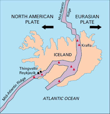
The eruption is located on about 2 km wide pass of ice-free land between
Eyjafjallajökull and the neighbouring Katla volcano with its overlying
Myrdalsjökull ice cap. Katla volcano is known for powerful subglacial
phreatomagmatic eruptions producing basaltic tephra layers with volumes
ranging from ~0.01 to more than 1 cubic kilometer.

Three previous eruptions of Eyjafjallajökull are known in the last 1100
years (historical time in Iceland). The most recent began in December 1821
and lasted intermittently for more than a year. The neighbouring volcano
Katla erupted then on 26 June 1823. Other eruptions include an eruption in
1612 or 1613, and about 920 A.D.

Episodes of unrest are known at Eyjafjallajökull, with documented sill
intrusions in 1994 and 1999.

For information see:

http://www.volcano.si.edu/world/volcano.cfm?vnum=1702-02=

http://en.vedur.is/

http://www.earthice.hi.is/

and the following references:
Sturkell, E., P. Einarsson, Freysteinn Sigmundsson, A. Hooper, B. G.
Ófeigsson, H. Geirsson and H. Ólafsson, Katla and Eyjafjallajökull
volcanoes, In: The Mýrdalsjökull Ice cap, Iceland - Glacial processes,
sediments and landforms on an active volcano. Developments in Quaternary
Sciences, vol., 13, eds. Anders Schomacker, Johannes Krüger and Kurt H.
Kjær, p. 5-21, 2009.

Hjaltadottir, S., K. S. Vogfjord and R. Slunga, 2009. Seismic signs of
magma pathways through the crust at Eyjafjallajokull volcanoe, South
Iceland, Icelandic Meteorological office report, VI 2009-013
http://www.vedur.is/media/vedurstofan/utgafa/skyrslur/2009/VI_2009_013.pdf

Hooper, A., R. Pedersen, F. Sigmundsson, Constraints on magma intrusion at
Eyjafjallajökull and Katla volcanoes in Iceland, from time series SAR
interferometry, In: The VOLUME project - Volcanoes: Understanding
subsurface mass movement, eds. C. J. Bean, A. K. Braiden, I. Lokmer, F.
Martini, G. S. O'Brien, School of Geological Sciences, University College
Dublin, p. 13-24, 2009

Larsen, G., 1999. Gosið í Eyjafjallajökli 1821-1823 (The eruption of the
Eyjafjallajökull volcano in 1821-1823). Science Institute Research Report
RH-28-99. 13 p. Reykjavík.

Oskarsson, Birgir Vilhelm 2009. The Skerin ridge on Eyjafjallajökull,
South Iceland: Morphology and magma-ice interaction in an ice-confined
silicic fissure eruption. M.Sc. thesis, Faculty of Earth Sciences,
University of Iceland. 111 p.
http://www.raunvis.hi.is/~mtg/nemritg/BV-MS_2009.pdf

Pedersen, R., Freysteinn Sigmundsson and Páll Einarsson, 2007: Controlling
factors on earthquake swarms associated with magmatic intrusions;
Constraints from Iceland, Journal of Volcanology and Geothermal
Research,162,73-80.

Pedersen, R., Sigmundsson, F., Temporal development of the 1999 intrusive
episode in the Eyjafjallajökull volcano, Iceland, derived from InSAR
images, Bull. Volc., 68, 377-393, 2006.

Pedersen, R., F. Sigmundsson, InSAR based sill model links spatially
offset areas of deformation and seismicity for the 1994 unrest episode at
Eyjafjallajökull volcano, Iceland, Geophys. Res. Lett., 31, L14610,
doi:10.1029/2004GL020368, 2004.

Sigmundsson, F., Geirsson, H., Hooper, A. J., Hjaltadottir, S., Vogfjord,
K. S., Sturkell, E. C., Pedersen, R., Pinel, V., Fabien, A., Einarsson, P.
Gudmundsson, M. T., Ofeigsson, B., Feigl, K., Magma ascent at coupled
volcanoes: Episodic magma injection at Katla and Eyjafjallajökull
ice-covered volcanoes in Iceland and the onset of a new unrest episode in
2009, Eos Trans. AGU, 90(52), Fall Meet. Suppl., Abstract V32B-03

Share this: Stumbleupon Reddit Email + More

Trackbacks

Trackback URL for this entry: http://scienceblogs.com/mt/pings/134184

Comments (91)

1

Hi erik:

Some reports says that the fissure is widening and some river have increased their flows and temperature....interesting.

Posted by: David Calvo | March 22, 2010 11:29 AM

2

Now with three our four active threads on Eyjafjallajökull on this blog, I feel a bit embarrassed about where to post the latest information on fine video and photos of this eruption - Erik, maybe you should close the possibility to comment in the older threads and lead new comments to the latest one?

Anyway. The eruption seems to be continuing on a rather small scale, from what can be seen in new videos and photos. Here's a selection of the most interesting material from today, Monday 22 March 2010.

Video: you may have noted that videos of the eruption posted on YouTube do not last long due to copyright issues. So it rather suits you to visit the original sources, mostly the RÚV news web site and Morgunblaðið.

(1) a distant view of the steaming eruptive fissure, with apparently no strong activity but you can see some new cinder cones – link:

http://http.ruv.straumar.is/static.ruv.is/vefur/Gos_Fljotshlid.wmv

(2) the eruptive fissure seen from the air during an overflight today (Monday 22 March) morning, with continued lava fountaining – link:

http://http.ruv.straumar.is/static.ruv.is/vefur/Gos_flug_22032010.wmv

(if you have problems with the direct links, here’s the page where the links are:

http://www.ruv.is/frett/sprungan-hugsanlega-ad-staekka

the videos are indicated by this text, after the first 3 paragraphs:

Hér má horfa á myndskeið sem tekið var austan við Hellu í morgun.

Annað myndskeið. Horfa )

Some beautiful new photos showing close-up views of the growing cinder cones have been posted on Flickr (and are referred to on Morgunblaðið, www.mbl.is - )

http://www.flickr.com/photos/24454986@N08/

Posted by: Boris Behncke | March 22, 2010 11:49 AM

3

I believe the eruptions at Myvatn in the 1980s were accompanied by earthquakes and the formation of grabens to the north of the eruption site, illustrating the interplay of tectonics and magmatism in a rift zone. So it would be possible (by no means certain) to see non-magmatic rifting along the strike of this vent.

With all the surface and shallow subsurface water in the eruption area I imagine we will see more of these phreatomagmatic blasts.

Posted by: EKoh | March 22, 2010 12:13 PM

4

I feel that I found the explanation for the somewhat stronger explosions seen this morning. If you watch this nice overflight video made during daylight today

http://http.ruv.straumar.is/static.ruv.is/vefur/Gos_flug_22032010.wmv

you can see how the active lava front drops into a steep gorge, and I am convinced that's where the phreatomagmatic explosion took place.

When there is somewhat turbulent mixing of lava with snow, this leads to fuel-coolant interactions, that is, phreatomagmatic explosions, and this can even generate small pyroclastic flows. We've seen this on Etna, especially in March 2007, when a lava flow first travelled over gently sloping terrain without generating explosions although it cut into snow about 10 m deep. But when the lava flow reached a steep slope, still deeply covered in snow, violent explosive interaction would start, generating a plume several kilometers high.

I guess that's what created the somewhat larger explosions seen this morning. Nothing to do with the vigor of the eruptive activity at the vents, it's a secondary explosive process.

Posted by: Boris Behncke | March 22, 2010 12:20 PM

5

@Boris, thank you for that cool link! It is really neat to be able to see what is going on and to get an explaination as well. I think you are right on as there is a lot of snow there, though they are saying there isn't any ice as in part of the glacier. It will be interesting to see if this will affect Katla or not. I hope not. At it is right now, this eruption is giving a nice show without hurting much right now, though the rivers in the area are rising in volumn and temp. I just hope it gives a good show and some really good info for volcanologists to study for a while.

Thanks again.

Posted by: Diane | March 22, 2010 12:40 PM

6

The fissure has kind of changed to two main vents. It doesn't look very different from what Eldfell on Heimaey looked like in 1973.

I can't get a very good perspective on the size of the cones, but they seem to have grown big, especially seen the fact that they started to form only 41 hours ago.

Thanks for the links, Boris! Here are some more pictures: http://visir.is/apps/pbcs.dll/gallery?Site=XZ&Date;=20100322&Category;=FRETTIR01&ArtNo;=902021452&Ref;=PH&Params;=Itemnr=11

Posted by: Gijs de Reijke | March 22, 2010 12:59 PM

7
Video: you may have noted that videos of the eruption posted on YouTube do not last long due to copyright issues. So it rather suits you to visit the original sources, mostly the RÚV news web site and Morgunblaðið.

The advantage of YouTube is that it's in Flash, which is widely supported. I'm not sure what format the original is in, but I certainly can't get it to play here.

Posted by: D. C. Sessions | March 22, 2010 1:01 PM

8

@ D.C. Sessions: Try the RÚV help page, http://dagskra.ruv.is/faq/

It's in Icelandic but you should be able to figure out why you can't play the videos.

I have a mac and it took me a while to figure out that I needed to download Windows media player (shudder) to play RÚV-videos on their website.

Posted by: Anna | March 22, 2010 1:56 PM

9

I'm on a Mac too, and I had to download the source video as a .mov (the default player in Firefox wouldn't play the video although it would load it and provide the 'save as .mov' option from the dropdown menu to the right of the player bar). I could then play that using Quicktime on my desktop. Bit of a palaver but worth it!

I'm really fascinated by all the updates on this eruption, so thanks to everyone for feeding my curiosity!

Posted by: Suw | March 22, 2010 2:11 PM

10

Suw | March 22, 2010 2:11 PM

I use Mac as well.
You can watch the videoon line if you make Quick time your preferred video reader in Firefox!


Posted by: R. de Haan | March 22, 2010 2:17 PM

11

Yes, the thing with embedded Windows media player files is a bit of a b***h. Especially if you want to save such files, just for personal pleasure - but there are some little tricks that can be helpful for Windows users, like that little gimmick you can add to Firefox that's called DownloadHelper (it's free), or a little software that captures streaming video and is called WM Recorder (this is not free but it costs something like 30 US$ and if you really WANT to have these videos I think it's affordable). I am sure there are similar thingies for Mac users.

Just a reminder, there are more and more (and often high-resolution and very spectacular) photos popping up on photo sites, in particular Flickr (that's Flickr-dot-com), just use the search function, type Eyjafjallajökull (or eldgos or Eyjafjallagos or Eyjafjallagosið or Gosstrókurinn or Eyjafjallajökli, or simply volcano etcetera) and make sure that you choose "recent" which will bring the latest additions up first.

Posted by: Boris Behncke | March 22, 2010 2:28 PM

12

More daylight footage on the BBC: http://news.bbc.co.uk/1/hi/world/europe/8580920.stm

At least, I hadn't spotted this elsewhere!

Posted by: Suw | March 22, 2010 4:05 PM

13

There is a recent (I think) update here:

http://www.icelandreview.com/icelandreview/daily_news/?cat_id=29314&ew;_0_a_id=359782

I won't post the whole thing, but it looks like the eruption is increasing, slowly but surely.

Seismologist Kristín Waagfjörd said "The eruption appears to have been increasing since 9 am this morning. We are probably looking at signs of increased lava flow"

Posted by: Brian in Bellingham | March 22, 2010 4:56 PM

14

@Brian Thanks for posting the link. But did you see that fantastic video (the closest I have seen so far) in that article? I post it in case it is not known yet: http://http.ruv.straumar.is/static.ruv.is/vefur/flug_beggi.wmv

Posted by: Thomas Wipf | March 22, 2010 5:05 PM

15

Thanks Thomas, I didn't catch that at first. This does look like newer video than others that I have seen.

Posted by: Brian in Bellingham | March 22, 2010 5:16 PM

16

#13 - the link photo shows lava activity that corresponds to the webcam images I mentioned last night. I wonder if the streaming webcam was temporarily moved to a hut used by hikers and guided tour folks?

Posted by: Passerby | March 22, 2010 5:26 PM

17

For those of you who are computer savvy, skip this post. For those who, like me COULD NOT figure out how to get those wmv's working, continue to read:).

For those of you with Macs, who tried everything (update quicktime, update flip4mac, download windows media player) and still got nothing, there's one more step:

open windows media player
go to the site and cc the url (the http bit)
click on windows media player
choose file, open url in the media player
paste in the url
hit return and it will show. RAH!!!

Posted by: parclair | March 22, 2010 5:47 PM

18

Sorry if this question has been answered already elsewhere, but the most recent footage, and especially this:

http://http.ruv.straumar.is/static.ruv.is/vefur/gos_thor.wmv

seems to show that there's a slight plume of ash coming from the fissure, and then a separate plume of what looks like steam. Is that the case? Is the steam coming from the meeting of lava and snow/ice, or is there another vent producing it?

Posted by: Suw | March 22, 2010 5:52 PM

19

"The eruption broke out... ...at N63º 38.1′, W19º 26.4′" According to the coordinates listed by the Iceland Meteorological Office (see tab "Tables"), the approximate centre of the earthquake activity is located at ~ N63.635 (63º 38.1') W 19.525 (19º 31.5') - i.e. ~4.5 km due west of the eruption - and has so been for the past ten days. This tallies with a comparison of the satellite IR image of the eruption site and the Iceland Meteorological Office map for Mýrdalsjökull.

Looking at the EQ data for the past two days, a large majority of quakes, irrespective of depth, show this offset to the west. An exercise of logic would indicate that the main intrusion is to the west, that it continues in spite of the relief of pressure provided by the eruption and that somewhere, there must have occurred a branching off from the main body. At what depth? Is the relief provided enough to stop the main body from breaking through under the glacier?

With the official position of the eruption as a reference, Soucel's graphic representation of the earthquake data http://islande2010.mbnet.fr/2010/03/eyjafjallajokull-levolution-des-dernieres-heures/ is very interesting yet again. The purple-and-blue patch to the right and slightly above centre ought to represent the intrusive body, surrounded by (red/yellow) earthquake activity where the magma interacted with rock on its way up. There are two other purple/blue areas on that map that are (almost) similarly enclosed - at 63.61 19.63 (corresponding to the position of the south edge of Eyjafjöll's main crater) and 63.60 19.53 (corresponding to an old cone/vent on the glacier's edge SE of the main crater visible in photographs) respectively. Are they artefacts of processing or do these purple/blue areas also represent magma intrusions?

Posted by: Henrik | March 22, 2010 6:49 PM

20
It's in Icelandic but you should be able to figure out why you can't play the videos.

Oh, I know why: no Linux codecs for the format.

I have a mac and it took me a while to figure out that I needed to download Windows media player (shudder) to play RÚV-videos on their website.

The difference is that Microsoft has no problems with Macs playing their format so that there is a player. Alas ...

Posted by: D. C. Sessions | March 22, 2010 7:39 PM

21

This info from earlier today suggest that the fissure might be slowly be growing towards northeast http://www.icelandreview.com/icelandreview/daily_news/?cat_id=28304&ew;_0_a_id=359761

Posted by: Mattias Larsson | March 22, 2010 7:56 PM

22

Is it just the wind or are the signals in the tremor plots on James site steadily increasing in strength? http://www.teamsnafu.net/eyjaf.html

Posted by: Mattias Larsson | March 22, 2010 8:01 PM

23

@Boris, since this is the most recent thread, maybe you should continue to post here.

I noticed in some of the pictures and also what I read from the links above that the lava is beginning to travel down a canyon. Does anyone know what the local volcanologists are expecting, or thinking, the effects of this will be? It seems like there is a lot of snow and they have said there isn't any ice in that area. Sure could have fooled me. I have a feeling the fissure is going to spread even further than it has and will keep going for a while. Just as long as it doesn't get too much more than it is right now. It is so facinating watching the lava produce cones. For several years I watched the SE crater on Etna grow and it has been intereting as well. (I should have gone into geology/volcanology!)

Posted by: Diane | March 22, 2010 8:42 PM

24

lookin at Jon Frimanns helicorders, i would say things are ramping up again (at least for now) seismically speaking, looks like the real thing (seismic swarm) to this geophysicist

http://www.simnet.is/jonfr500/earthquake/tremoren.htm

Jon's helicorders are the ones to look at, the others don't have enough temporal resolution (IMHO)

Posted by: robert somerville | March 22, 2010 10:24 PM

25

Socuel's graph also indicates highly erratic behavior, consistent with 'ramping' up events. Too bad webcam images are blocked by weather at present - when the clouds parted briefly a few hours ago, the incandescence was remarkable from Hekla.

Posted by: Passerby | March 22, 2010 11:03 PM

26

Researching the quakes tonight to the east of Hekla, I came across this most stunning photo.

Hekla's last eruption
lava field with a dash of Aura borealis!

http://homepage.ntlworld.com/jmikeshaw/volcanoaurora.jpg

Posted by: JDZ | March 22, 2010 11:46 PM

27

@robert somerville, You are seeing wind, not the volcano. The weather is quite bad in the area and that affects my instruments. But when the weather gets better, something should appear on my geophone hopefully.

I do know that my geophone is recording constant noise at 2Hz when it is not overrun by wind.

The eruption continues with no signs of stopping any time soon.

Posted by: Jón Frímann | March 23, 2010 12:08 AM

28

Was there a big flash on the Hekla cam in the last couple of minutes? Lightening?

Posted by: parclair | March 23, 2010 1:33 AM

29

There appears to be lightning activity in that area now.

http://andvari.vedur.is/athuganir/eldingar/vikan_is.html?

Posted by: Jón Frímann | March 23, 2010 3:37 AM

30

Large phreatic explosion at 8.30 pm "leytid" (daylight saving time?), altitude 7km.

http://www.ruv.is/frett/eldgosid-jafnt-og-stodugt

Posted by: Henrik | March 23, 2010 3:50 AM

31

Some video of the second day with captions: http://www.youtube.com/watch?v=iIBGsrc8fAM

Posted by: Suw | March 23, 2010 5:49 AM

32

Those of you who can read Icelandic, should visit this blog - it's made by world-famous volcanologist Haraldur Sigurdsson.

http://vulkan.blog.is/blog/vulkan/

Posted by: Boris Behncke | March 23, 2010 6:13 AM

33

@Henrik: "Leytið" means approximately.

Local time in Iceland is GMT (all year round).

Posted by: Anna | March 23, 2010 7:52 AM

34

There are two new webcams looking at Eyjafjallajökull, from locations named Hvolsvelli and Þórólfsfelli.

The video is streaming, and currently all you see is bad weather.

http://mila.is/eldgos/

Posted by: Boris Behncke | March 23, 2010 9:15 AM

35

http://reykjavik.mydestinationinfo.com/en/hekla-volcano-webcam
also shows these new webcams (on the same page) and has a map pin-pointing their location with an arrow indicating the site of the current eruption.

Posted by: Henrik | March 23, 2010 10:03 AM

36

The IMO has posted a map of the eruption site and lava flow - it appears really, really small thus far.

http://www.vedur.is/skjalftar-og-eldgos/frodleikur/greinar//nr/1847

Posted by: Boris Behncke | March 23, 2010 10:12 AM

37

Here in the Eastern USA, NO ONE is covering this AT ALL -- probably because our intrepid journalist community still can't pronounce "Eyjafjallajokull." I'm getting all my info from ScienceBlogs, BBC and al Jazeera.

Posted by: Raging Bee | March 23, 2010 10:38 AM

38

@36 Boris, thanks for the link. Yes this looks like a typical basaltic fissure eruption at the moment. I would speculate (as an igneous petrologist and not a seismologist mind you) that a good portion of the quake activity is associated tectonic extension. But we'll have to see the "beach-balls" and hear from a seismologist on that.

@37 I'm not one to let the media off the hook, but there has been coverage, but IMHO I think the healthcare story deservedly gets attention today. Remember though that there are similar size eruptions that occur all the time and get zero coverage anywhere. Despite excited speculations from eager amateurs, we have no clear indications where this eruption will go and none yet that suggest anything more explosive.

Posted by: EKoh | March 23, 2010 11:07 AM

39

On the media, here on the "left coast" USA, I informed one of the local tv stations about the eruption as it happened and it took them a couple of days to post something about it. They were glad to get the tip.

@EKoh, you are right about the health care issue taking all the media time. It seems unless it is a major-major event, it doesn't get covered. Oh well...at least WE know what is going on! Great coverage!!

Posted by: Diane | March 23, 2010 11:34 AM

40


The 1821 eruption started slowly, too.

Posted by: Passerby | March 23, 2010 12:21 PM

41

Based on the seismicity map it appears to me that the previous east-west EQ line moved to SW-NE, which means that the current fissure is the 'winner' one, and further magma will come up in the same channel.

There were 3 very shallow (less than 0,5km) EQs in the last 30 minutes, perhaps the fissure will widen tonight towards SW.

By the way, i have not seen Korf lately... i would be really keen to see his updated 3D plots.

Posted by: Viktor | March 23, 2010 12:35 PM

42

..shhh.. one of the recent ones was corrected to 4.2kms.
I guess i need to wait for longer before any estimation. :)

Posted by: Viktor | March 23, 2010 12:48 PM

43

@boris 36 Thanks for the link. I was amazed at how well it matches the MODIS map.

I learned something-- what I thought were smoke/ash streams on the MODIS map turned out to be the new lava beds.

@ all, thank you for such an entertaining and informative thread.

Posted by: parclair | March 23, 2010 12:57 PM

44

There is a possibility that a new fissure did open up at 16:16 today, about 5km south of Básar. The reason for that is that the earthquake that did happen on the automatic system appeared at 0km before it was downgraded. But that is the same signal as did appear before the eruption started on 20th of March 2010 it seems.

However, the weather in the area is quite bad at the moment and nothing can be seen at the moment. So this remain a speculation. However I estimate that the probability is high that new fissure has opened in Eyjafjallajökull.

Posted by: Jón Frímann | March 23, 2010 1:22 PM

45

Wouldn't be a surprise at all, Jón, as we've all seen how the EQ activity has been focused at ~5.5 km SSW Básar over the past week, even post-eruption. Right now, the weather seems to be improving slightly & "webcam 2" at Þórólfsfelli (?) might soon give us an indication.

@Anna (#33) I suspected I might have gotten that wrong, thank you!

Posted by: Henrik | March 23, 2010 1:54 PM

46

New tremor graphs, updated every ten minutes:
http://hraun.vedur.is/ja/Katla2009/stodvaplott.html#googtrans/auto/en

Posted by: scott | March 23, 2010 2:21 PM

47

I've been digging a bit in the Internet these days, looking for on-line Icelandic newspapers and journals concerning volcanism, in the sense of downloadable material. This is obviously most interesting for people who can make at least a tiny little bit of sense of the language.

I've come across a web archive that has virtually all issues of the daily newspaper Morgunblaðið since its foundation in 1913. Issues through April 1949 are in pdf format and from May 1949 in djvu format (you need the LizardTech DjVu viewer to open this format, it's free); since January 2001 it's again pdf. Unfortunately, you can download only one page at a time, but if you just look up the issues of 30 March 1947, 6 May 1970, 19 August 1980, and 2 November 2004, you will understand that it's worth the effort.

Here's the index - I guess many of you will now spend hours in digging through these archives. And if you look around, you will find still much more, other newspapers and journals, often with things of volcanological interest.

http://timarit.is/view_page_init.jsp?pubId=58⟨=en

Note that newer issues will be accessible online only after 4 years - that means, 2008 issues will be available in 2012 and the most recent accessible issues are of 2006.

Posted by: Boris Behncke | March 23, 2010 2:29 PM

48

@Diane (#23):

The eruption is not in the glacier proper, i.e. Eyjafjallajökull. It's in the area between two glaciers (Eyjafjallajökull and Mýrdalsjökull). Sure there is some snow in the area now but not massive amounts of glacial ice.

The fissure is only one or two km away from a hugely popular hiking trail, Fimmvörðuháls ("Five-Cairn-Ridge"). A 10 hour hike but a rather treacherous one. Hikers are hugely exited because this small eruption is sure to change the landscape somewhat:)

Here you can see some pics of the Fimmvörðuháls trail:
http://blogg.visir.is/photo/tag/fimmvor%C3%B0uhalsi/

Posted by: Anna | March 23, 2010 3:24 PM

49

Thats a great link Boris. Unfortunately I can´t read icelandic

Posted by: Mattias Larsson | March 23, 2010 3:25 PM

50

Latest picture from http://www.ruv.is/frett/nyjar-myndir-af-gosinu Judging by pictures from only two days ago, there's been quite some growth.

Posted by: Henrik | March 23, 2010 4:16 PM

51

Also, there is a report of a 4(?) km long lava stream with a good close-up map of the Fimmvörðuháls area between the glaciers http://www.ruv.is/frett/hraunstraumur-nidur-hrunagil

Posted by: Henrik | March 23, 2010 4:21 PM

52

Nice picture Henrik. Looks like there could be a spatter/cinder cone forming.

Posted by: EKoh | March 23, 2010 4:22 PM

53

Another goodie here: the pdf version of the newspaper Vísir (free download); today's (23 March) issue has a couple of very spectacular photos of the eruption (a thumbnail can be seen at left, click on "PDF" below).

http://vefmidlar.visir.is/VefBlod/?paper=fbl

It still looks like a rather minuscule event ... and unfortunately, the live-cam still shows clouds over the volcano.

Posted by: Boris Behncke | March 23, 2010 4:30 PM

54

Hi all!

Someone on strahlen.org just posted this link: http://http.ruv.straumar.is/static.ruv.is/vefur/23032010_gosmyndir.wmv

One of the best videos so far!

Posted by: Gijs de Reijke | March 23, 2010 5:55 PM

55

Hey Gijs, I got this link from here...

And as an answer to post 20: I'm using Linux to watch this video...

Posted by: Günter Frenz | March 23, 2010 6:02 PM

56

There's a great gallery of photos here:

http://www.visir.is/apps/pbcs.dll/gallery?Avis=XZ&Dato;=20100323&Kategori;=FRETTIR01&Lopenr;=577699273&Ref;=PH

Some of them really are stunningly good. It's been years since I even thought about volcanoes, but I'm really enjoying brushing up on my knowledge! Thanks to everyone for the continued links and intel.

(PS. One of my earlier comments seems to have been lost in your moderation queue. :( )

Posted by: Suw | March 23, 2010 6:15 PM

57

Lol, that figures XD . Thanks anyway ^_^ !

The fissure is still a fissure... Yesterday I thought it had changed into two scoria cones. But the reports of the fissure being larger than it was on the 22nd don't seem very credible either.

Posted by: Gijs de Reijke | March 23, 2010 6:21 PM

58

@Mattias Larsson (49). "Can't read Icelandic".

One of the many things I learned about during this thread is google translate. If it's available to you, it's fairly easy to use:

1. Open up the site and copy the 'http: etc' (url)
2. Go to google translate
3. Paste in the url and pick the from and to languages.

The Icelandic/English translation is good enough to make some sense of a discussion. (Technical terms seem to slip by)

Hope this helps, and that it is available to you.

Posted by: parclair | March 23, 2010 6:33 PM

59

Regarding Google Translate, you can also add a little button to your browser bar that you click when you want to translate a page into your own language. All I do when I reach the Icelandic pages is hit my 'English' button and bingo, it comes up with a fair-to-middling translation. Much quicker than cutting and pasting the URL if you have to translate pages frequently.

Posted by: Suw | March 23, 2010 6:41 PM

60

Parclair - unfortunately, Mattias discovered as I did, that the old Icelandic newspapers are pdfs of scanned images. Google translate will not recognize and translate an image file.

Posted by: Passerby | March 23, 2010 6:50 PM

61

@Gijs de Rdijke (57)

I went to look at MODIS again and looked at the Eyjaf map. It looks to me like the hot spot has expanded, and moved a little west since 2 days ago.

Is that the impression of others?

Posted by: parclair | March 23, 2010 6:52 PM

62

The video on post 54 is very nice. The lack of viscosity is amazing. I noticed one jet looked like a H20 coming out of a hose. Are Icelandic basalts lower in SiO2 than say Hawaiian or other hotspot volcanos?

Posted by: Doug C. | March 23, 2010 7:10 PM

63

There are many satellites in polar orbit, would it be feasible for those with far-infrared cameras to look down through the cloud cover to document details not visible to ground cameras due to the weather?
I understand the eruption may not be unique, but the combination of detailed seismic data and detailed optic/IR images thorough the eruption would make it more interesting... the weather patterns are such that eruptions in Iceland rarely are favoured by good visibility lasting through the whole event.

Posted by: Birger Johansson | March 23, 2010 7:59 PM

64

@62 Doug C.
Overall, Hawaiian lavas tend to be less silicic than basalts erupted elsewhere. However, this does not preclude Iceland from having some really low-silica lavas.

The settings of Hawaii and Iceland are a bit different. Hawaii is a hotspot associated with a likely mantle plume. There is definitely a hotspot in Iceland, but the plume model is less certain (although I haven't kept up with the literature on Iceland, so the current thinking may be different). Also, Hawaii is in the middle of plate, whereas Iceland is on divergent plate boundary or spreading center. As a result, Hawaiian lavas tend to be somewhat hotter melts originating from a higher percentage of partial melting of the mantle, which produces lower silica basalts. Again these are generalities, specific eruptions will vary.

Posted by: EKoh | March 23, 2010 8:13 PM

65

Parclair & Suw:

Thanks, I appreciate the thought! I use Google Chrome so I can translate webpages very easy. Unfortunately it is as Boris sais and it is not possible to translate by using google.

:)

Posted by: Mattias Larsson | March 23, 2010 8:35 PM

66

MODVOLC (U Hawaii) Near-Real Time Thermal Imaging shows the rift, but detail resolution is disappointing.

Google Earth Community has an map with image overlay.
Shows a map of the flow from the Eruption as an overlay image, together with locations of the Eruption, and the hut on Fimmvörðuhálsi.

http://bbs.keyhole.com/ubb/ubbthreads.php?ubb=showflat&topic;=878276&gonew;=1

A more tourist-y presentation from GeoCurrent Events Google Earth Tour):
The Eyjafjallajokull Eruption Illustrated
http://geocurrentevents.blogspot.com/2010/03/eyjafjallajokull-eruption-illustrated.html

Posted by: Passerby | March 23, 2010 8:47 PM

67

At 21:29:12 local time there was an 2.4 earthquake at 0.1km depth close to the area with current activity.

Posted by: Mattias Larsson | March 23, 2010 8:53 PM

68

@Anna #48, thank you for the post and letting me know about where the fissure is. I knew it was between Eyjaf and Myrdal, and I had a pretty good idea where it was. The maps you sent helped me to see even better.

It was just the first pics looked like it was under ice. I wish I could come to Iceland sometime. Wish I was there now! At least I was able to keep tabs on this and follow it though to the eruption and then some. I hope it doesn't get too big and cause a lot of trouble for Iceland. A good show is fine. Explosive stuff, not so good.

Thanks again. It really helped put it all in perspective.

Posted by: Diane | March 23, 2010 8:55 PM

69

"There is definitely a hotspot in Iceland, but the plume model is less certain"

Mind you, I am not an expert but it is my understanding that Iceland is on a spreading center between two plates. As such, it would seem intuitive to me that unlike a volcano in a subduction region, the magma would be expected to be more basaltic and have a lower silica content.

http://upload.wikimedia.org/wikipedia/commons/a/ab/Iceland_Mid-Atlantic_Ridge_Fig16.gif

Iceland is where the mid-Atlantic ridge exists above sea level. So this is certainly fed by a "mantle plume", the same "mantle plume" that feeds the rest of the ridge and is causing the Atlantic to widen. I would think it possible for volcanism here to continue nearly indefinitely. So if volcanism at the current rate continued for a week, a year, or a decade it would not seem extraordinary to me. Nor would it seem out of the realm of possibility for the fissure to expand, even if it were to expand completely across Iceland. While that would be unusual in the context of the past several hundred years, it might not be so unusual in a longer context of millions of years since if formed in the Triassic.

Posted by: George | March 23, 2010 9:24 PM

70

@George 69. Both the hot spot and plume are consensus models that should be disputed and as Ekoh says are being:
http://www.mantleplumes.org/index.html

Posted by: Peter Cobbold | March 23, 2010 9:49 PM

71

"Mantle plume" would probably not be the best description of this location, in my opinion. It is more of an active rift between plates.

Posted by: George | March 23, 2010 10:02 PM

72

WORK MAPS - I've made up three panoramic maps of Eyjafjallajökull, with different resolutions (one showing the location of the fissure eruption. These are gridded with latitude and longitude, for reference to quakes and magma extrusions.

Open use. http://michaelbix.livejournal.com

Posted by: Michael Cerulli Billingsley | March 23, 2010 10:09 PM

73

What is the future of Iceland? (geologically speaking)
Being a very looong west-east island?

Posted by: Guillermo | March 23, 2010 10:14 PM

74

@George
Iceland is indeed on a rift - the divergent boundary between the North American and Eurasian Plates. Due to spreading of the plates, which are comprised of the crust and uppermost mantle, a deeper, more plastic part of the mantle rises up. This hotter mantle rock rises without cooling very much and reaches a shallower depth and lower pressure (say 80-60 km), where its temperature will be above its melting point. This will give you a basaltic magma. This "decompression melting" process occurs sporadically around the world on ocean ridges and rises. Tension and rifting of the crust also occurs, often without magmatism.

Now the fun part. Iceland is above a localized area of higher mantle temperatures, upwelling and enhanced melting, a hotspot. So in simple terms Icelandic lavas can be said to be the result of upwelling from both rift and hotspot processes.

Interestingly there are several locations around the world where hotspots coincide with divergent boundaries, including Iceland. However,unlike the plates and plate boundaries,the hotspots are considered to be fixed in place.

The big questions revolve around what creates such hotspots. The textbook model is that a "plume" of deep hot mantle rises in those locations and undergoes decompression melting near the surface. The problem has been that while this model and, the evidence for it, works well in Hawaii, its applicability elsewhere is questioned. The 2004 (I think) Fall Meeting of the American Geophysical Union devoted a whole session to the hotspot/plume issue.

Posted by: EKoh | March 23, 2010 10:45 PM

75

@michael 72

Thank you. Bookmarked. I'm estimating that a 0.1 degree at that longitude is around 4 miles? (at 45 degrees, it's around 6 miles). Sound close?

Webcam 2 has a clear view right now.

Posted by: parclair | March 23, 2010 10:47 PM

76

This may already have been posted, I apologize if I missed it.
The GVP at the Smithsonian ( www.volcano.si.edu ) has a nice summary of the eruption.
Here is a portion:
"The eruption broke out with fire fountains and Hawaiian eruptive style on about 500 m long NE-SW oriented eruptive fissure at N63º 38.1', W19º 26.4' on the NE shoulder of the volcano at an elevation of about 1000 m. It was observed from air from 4-7 am. on 21 March. Lava flowed a short distance from the eruptive site, and a plume below 1 km altitude blew W. Volcanic explosive index (VEI) is 1 or less. Tephra fall is minor or insignificant. The eruption occurs just outside the ice cap of Eyjafjallajökull, and no ice melting is occurring at present.

The eruption is located on about 2-km-wide area of ice-free land between Eyjafjallajökull and the neighbouring Katla volcano with its overlying Myrdalsjökull ice cap. Three previous eruptions of Eyjafjallajökull are known in the last 1100 years (historical time in Iceland). The most recent began in December 1821, which lasted intermittently for more than a year. Other eruptions include an eruption in 1612 or 1613, and about 920 A.D. Episodes of unrest are known at Eyjafjallajökull, with documented sill intrusions in 1994 and 1999."

Posted by: EKoh | March 23, 2010 10:51 PM

77

@parclair - I believe, using my additional grid over the Iceland Meteo (further down the same page) the .1 degree of Longitude (at 63.6°N latitude) is close to, if not exactly, five (5) kilometres.

The vertical (Latitude) dimension of this topo view is quite elongated by comparison, so the same measurement does not apply. In the original panorama, i used a grid of 284h x 308v pixels after much futzing around to find a match to the map coordinates.

And do please note that the vertical grid is in .05° increments of Latitude versus .1° increments of Longitude horizontally.

Posted by: Michael Cerulli Billingsley | March 23, 2010 11:13 PM

78

Q: Is the 1999 report, Gosið í Eyjafjallajökli 1821-1823 published only in Icelandic, or is it bilingual (Icelandic/English)??

Posted by: Passerby | March 24, 2010 12:43 AM

79

@ Anna (#48)

Thank you! That is indeed a treasure trove, the topographic map in particular. I also enjoyed the photograph of the eruption site with the little lakelet.

Posted by: Henrik | March 24, 2010 2:39 AM

80

brief pdf from the Institute of Earth Sciences showing exact location and volume:

http://www.earthice.hi.is/solofile/1015729

Posted by: bruce stout | March 24, 2010 4:26 AM

81

Webcam 2 now (08.16 GMT) shows what APPEARS (though I may be mistaken) to be three eruptive points - the original one to the left, one above and to the SSW of Merkurtungnahaus and to the right one above and to the S of Skaratungnahaus near the centre of the webcam image (cf map provided by Anna #48 - again thank you!). Both the new(?) vents are on the edge of the ice/snow. Since visibility varies, at times there seems to be five points along this extended line that produce black smoke.

I have not yet seen any confirmation of this on RUV or MBL, so please, do not take this as written in stone!

Posted by: Henrik | March 24, 2010 4:31 AM

82

(08.40 GMT) Visibility has mproved and the cloud cover lifted enough to reveal two further points emitting jet-black smoke: One on the snowline in the valley above and to the S of Steinholtsjökull and one on the glacier half-way up the first visible, easternmost peak.

Again, just an observation without confirmation.

Posted by: Henrik | March 24, 2010 4:43 AM

83

Hi Henrik,
what webcam are you using? All I can see is cloud.

Posted by: bruce stout | March 24, 2010 5:34 AM

84

Hi Bruce!

http://reykjavik.mydestinationinfo.com/en/hekla-volcano-webcam

I saw the same thing earlier at ~06.20 GMT but as it was more or less through the cloud cover I wasn't certain whether it was rock, a lighting phenomenon or an eruption I saw. Once the cloud cover eased, I was certain I saw something other than rock and regular clouds.

If correct, it seems Jón's #44 may be vindicated. Let me add, again, I am very impressed by your prediction of the type of eruption!

Posted by: Henrik | March 24, 2010 5:52 AM

85

thanks! you must have got lucky. I have had that on for a while too but probably missed the gap in the clouds.

as for the prediction I was pretty impressed too! :lol: kind of a "fools rush in where angels dare to tread" I am afraid. Did you notice how none of the professionals were making any predictions like that? Now THAT is the voice of experience. ;-)

Posted by: bruce stout | March 24, 2010 6:11 AM

86

As a complete amateur, i also feel happy i could predict the same at #41. But it was more luck than experience for sure. :)

Posted by: Viktor | March 24, 2010 6:35 AM

87

The view has changed, the webcam has zoomed in on the first fissure and lava flow, nice view btw. The things I observed this morning are to the west (right) of the current view provided.

Viktor! Well done, an e-Beer pehaps? I too will have reason to feel smug if this should be true as I've been harping on about the area ~5.5 SW of Básar for some time.

Bruce! Plain luck? Skill, sayeth I! But I have every respect for the professionals who cannot present what they believe even on a blog as it might have severe repercussions not only for them personally, but also for their universities and the science as a whole if their opinions prove incorrect. Yet, I had the feeling that when Gijs asked you, pre-eruption, what made you predict a Hawaiian eruption of low-viscosity baslatic lava, it was because he privately shared your conviction. ;)

Posted by: Henrik | March 24, 2010 7:16 AM

88

Diane, Henrik, you're welcome.

Here's a video some snowmobilers put on facebook. They got pretty close to the eruption:

http://www.facebook.com/video/video.php?v=107567322601082&ref;=nf

Posted by: Anna | March 24, 2010 7:20 AM

89

@Henrik Thanks :) I'll cross my fingers for your 5.5SW location.

I wonder if there is any tool to map the magma below the surface apart from relying only on EQs.
I would imagine a radar/HAARP-kind of machine, which could predict the volcanic activity for the next X days, just like we can predict the weather based on oncoming moisture/pressure zones in the air.

Posted by: Viktor | March 24, 2010 8:03 AM

90

Mag 3 quake on Reykjanes Ridge 10:50am

Posted by: Mike | March 24, 2010 8:21 AM

91

A pretty interesting PDF with some photos and information has been released by the University of Iceland:
http://www2.norvol.hi.is/Apps/WebObjects/HI.woa/swdocument/1015729/Results+from+observations+flights+22.+mars.pdf

Posted by: Chris | March 24, 2010 8:43 AM

Post a Comment

(Email is required for authentication purposes only. On some blogs, comments are moderated for spam, so your comment may not appear immediately.)

ScienceBlogs

Search ScienceBlogs:

Go to:

Advertisement
Read ScienceBlogs WATER posts and download National Geographic's Water Issue.
Read ScienceBlogs WATER posts and download National Geographic's Water Issue
Advertisement
Collective Imagination

© 2006-2009 ScienceBlogs LLC. ScienceBlogs is a registered trademark of ScienceBlogs LLC. All rights reserved.